Wednesday, June 24, 2015
Snowville Loop, 9:00 am
Thursday, June 25, 2015
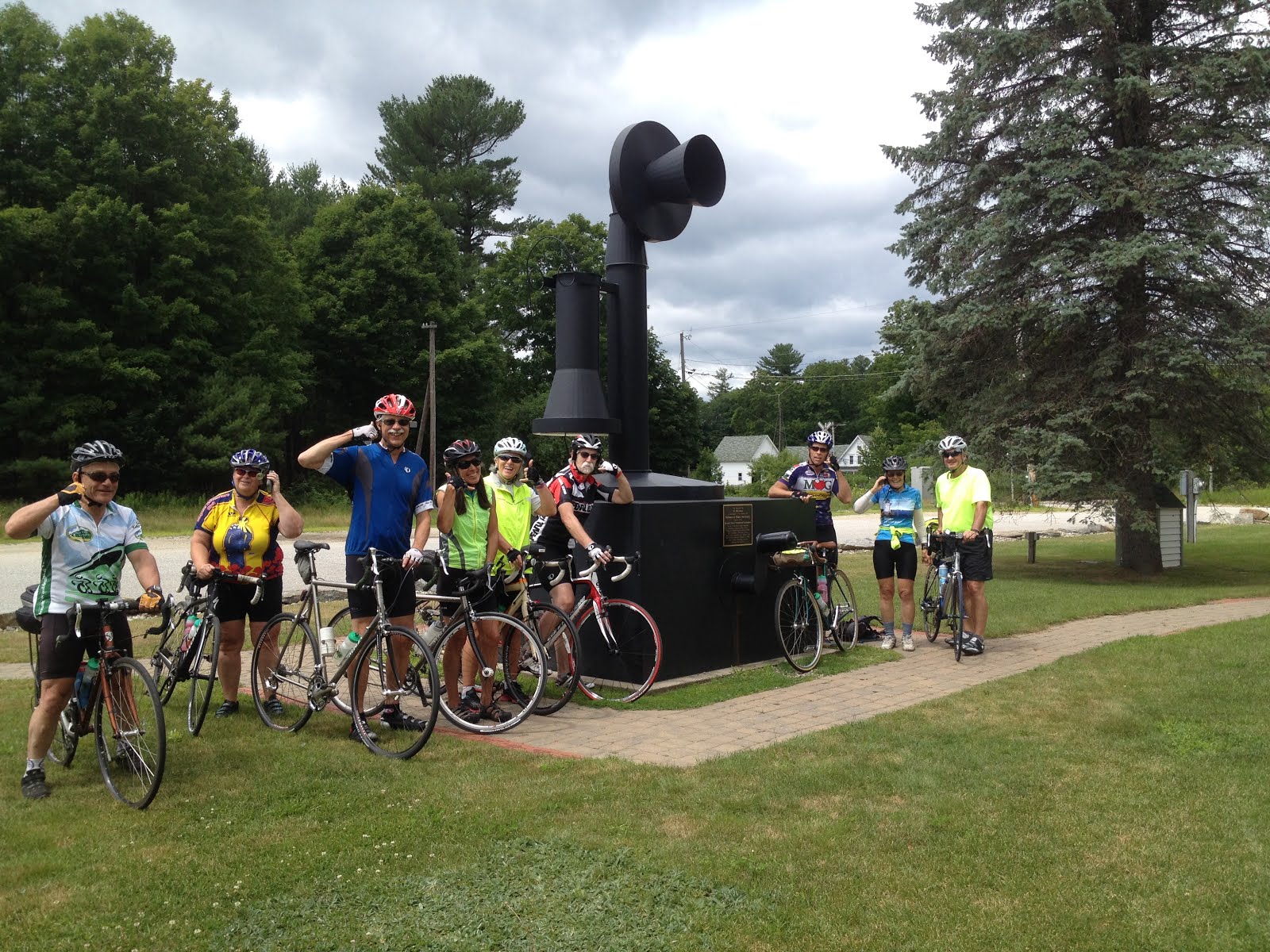
Nice day for the Snowville Loop!
Meet at the riverside park, on the right, just past the police station on East Conway Road. Drive down the entrance road to the parking and picnic area on the Saco River.
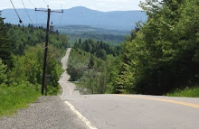
The ride goes back out to East Conway Road, then left to the stop sign, take a left onto Route 302, cross the Saco River, take a left at the lights to head towards Center Conway, then take a right onto Mill Street to ride by the beach on Conway Lake, up Brownfield Road to Hampshire St, and up the famous Asparagus Hill. This hill is the yearly test of how far you can ride up before having to jump off the bike before tipping over...
The reward is a great ride to Crystal Lake. You may be able to picnic there, but since most of us are not Eaton residents they may not let us hoodlums enter. Try the picnic tables located in the pines on the lake a short distance down 153 on the left, before the Eaton Store.
Return by Route 153 to Stark Road (right turn at a four corners. This is a nice riding road that cuts out half of route 153 and avoids Conway Village lights and traffic). When you come to the end of Stark Road, where it meets route 113, you can take a right onto Odell Hill Road, which runs parallel to route 113 for a short distance. Then you pop out back on 113 and come to the lights at Route 302 where you go left. Take the right back onto East Conway Road and right again after the police station into the park. Take a dip in the river if you like!
I will be on a hike, so I will see you all next week. I know that you all know this ride, and will help guide any newcomers!
Distance = 25 miles
Meet at the riverside park next to the police station on East Conway Road.
Ready to Ride at 9:00 am!
Here is a map of the ride!
http://www.mapmyride.com/routes/view/21252684
Tuesday, June 16, 2015
Franconia Notch Bike Path 9:00 am
Thursday, June 18th, 2015
Looks like we have good weather to ride the Franconia Notch Bike Path this Thursday!
I like setting up our ride over there early in the season, before it gets too crowded.
I like setting up our ride over there early in the season, before it gets too crowded.
Meet at the Loon Ski Area parking lot, ready to ride at 9:00 am. Starting at Loon, we ride the back roads of Lincoln to Clark's Trading Post, up Route 3 to The Flume, then enjoy the roller coaster of a bike path. It is about 32 miles round trip.
For those that want a shorter ride, start at The Flume for a 19 mile ride. Park near the bike path, at the northern end of the lot, up on the left relative to the entrance off of Route 3. Meet the riders coming up from Loon at about 9:50-10:00.
If you want to carpool, meet at the Attitash parking lot at 8:00 am. If you like, there is good food and home brew at the Woodstock Brewery for après-bike. If you have the NPR or NHPTV discount card bring it for a 2-for-1 meal deal.
Here is a map:http://www.mapmyride.com/routes/view/7074752
Tuesday, June 9, 2015
The Lupine Ride 10:00 start
Thursday, June 11, 2015
Ready to Ride at 10:00 am
The Weather: Looks good for Thursday!
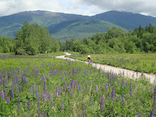
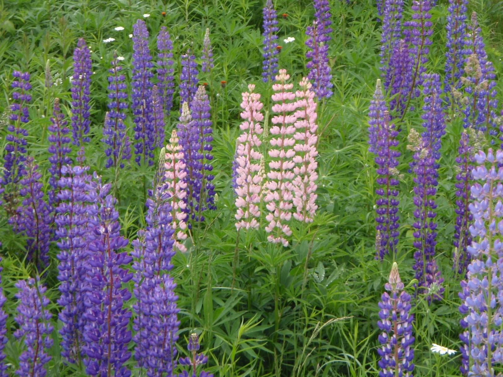
The Lupine Ride: This is Lupine Festival Week in Sugar Hill, lupines are blooming in my yard, so I presume the lupines will be blooming in Jefferson!
The Ride: This route in Randolph and Jefferson goes by some of the best displays of panoramic scenery and lupine fields in the area. The ride includes the entire length of Valley Road, a hidden treasure, running in the valley parallel to Route 2 but without the traffic. Valley Road lacks pavement for about 2 miles, but the riding on it is typically fine (unless it was recently graded). Take your time and enjoy the view. Durand Road is a terrific ride also, lined with summer houses from the 30's and their nice gardens. Lunch and snack stop will be a the Jefferson hilltop general/convenience store.
Start time: 10:00 am ready to ride in Randolph at the parking lot on the west end of Pinkham B Road at the rail trail crossing.
Carpool: Meet at the Jackson Ski Touring/Wentworth Golf Club parking area across the street from the J-Town Deli at 9:10 am.
Ride length: 26 or 32 miles, depending on whether we opt to ride up to Jefferson or just stay in the meadows.
Directions to the start: The start is at the Randolph end of the Pinkham B Road. There is parking right next to where the Presidential Rail Trail crosses Pinkham B. Access Pinkham B Road from the Dolly Copp Campground entrance off of Route 16. As you drive down the hill on Pinkham B and come out of the woods, where there are 2 houses on the left, the rail trail crosses the road at a public works department building. There is parking on the left side near the rail trail.
If you don't want to drive Pinkham B's dirt and "pavement", drive route 16 to Gorham, follow it towards Berlin and take a left on Route 2 at the traffic light. Go up the big hill and down the other side. Just after the hill flattens, Pinkham B Road will be on your left. Take the left and drive about 0.5 mile to the parking area near the rail trail on the right.
Ready to Ride at 10:00 am
The Weather: Looks good for Thursday!
The Lupine Ride: This is Lupine Festival Week in Sugar Hill, lupines are blooming in my yard, so I presume the lupines will be blooming in Jefferson!
The Ride: This route in Randolph and Jefferson goes by some of the best displays of panoramic scenery and lupine fields in the area. The ride includes the entire length of Valley Road, a hidden treasure, running in the valley parallel to Route 2 but without the traffic. Valley Road lacks pavement for about 2 miles, but the riding on it is typically fine (unless it was recently graded). Take your time and enjoy the view. Durand Road is a terrific ride also, lined with summer houses from the 30's and their nice gardens. Lunch and snack stop will be a the Jefferson hilltop general/convenience store.
Start time: 10:00 am ready to ride in Randolph at the parking lot on the west end of Pinkham B Road at the rail trail crossing.
Carpool: Meet at the Jackson Ski Touring/Wentworth Golf Club parking area across the street from the J-Town Deli at 9:10 am.
Ride length: 26 or 32 miles, depending on whether we opt to ride up to Jefferson or just stay in the meadows.
Directions to the start: The start is at the Randolph end of the Pinkham B Road. There is parking right next to where the Presidential Rail Trail crosses Pinkham B. Access Pinkham B Road from the Dolly Copp Campground entrance off of Route 16. As you drive down the hill on Pinkham B and come out of the woods, where there are 2 houses on the left, the rail trail crosses the road at a public works department building. There is parking on the left side near the rail trail.
If you don't want to drive Pinkham B's dirt and "pavement", drive route 16 to Gorham, follow it towards Berlin and take a left on Route 2 at the traffic light. Go up the big hill and down the other side. Just after the hill flattens, Pinkham B Road will be on your left. Take the left and drive about 0.5 mile to the parking area near the rail trail on the right.
Map: http://www.mapmyride.com/us/berlin-nh/durand-road-and-valley-road-route-18419892
Wednesday, June 3, 2015
Bear Notch Loop: Look for the Ladyslippers 9:00 am
Thursday June 4th
The ladyslipper orchids are in bloom in the woods and by the roadsides. for the last few years they have put on quite a show on Bear Notch Road, particularly the roadside ditches near the gate on the Kanc side.
It should be a beautiful day for this ride!!
Meet at the public parking lot behind the Eastern Slope Inn in North Conway. I suggest doing it counterclockwise, but you can take a vote!
Ready to Ride at 9:00 am
Enjoy!! Again, I will not be able to join you this week!! I will miss you all!
Stay tuned, that Franconia Notch Bike Path ride is coming soon!!!
Subscribe to:
Posts (Atom)