Wednesday, September 29, 2010
Ride Cancelled for Thursday, Sept 30th
Due to the forecast of rain, the ride is cancelled this week. This is too bad, since the foliage is spectacular above the notches!! Next week!!!
Wednesday, September 22, 2010
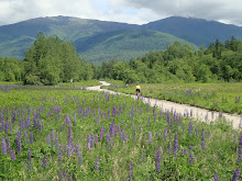
Bear Notch Loop with Early Fall Foliage
Thursday September 23rd
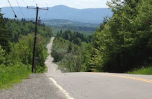
The foliage is starting to get brighter, especially in the Lincoln/Kanc area. For a glimpse of the local colors, how about the Bear Notch Loop?
Meet at the public parking lot behind the Eastern Slope Inn in North Conway. You can decide whether to ride up West Side Road to Bartlett (38 mile ride) or go via 16A to Glen (40 mile ride).
Ready to Ride at 9:00 am
Enjoy!! Again, I will not be able to join you this week!! I miss you all and I miss my bike!!
Wednesday, September 15, 2010
North Conway, Intervale and Jackson Loop
Thursday, September 16
This ride explores local roads in North Conway, Intervale and Jackson for a nice loop. Start by riding through North Conway to Cranmore and take Old Bartlett Road to the North end of Kearsage Road, then down Hurricane Mt Road down to Route 16. There, turn onto Route 16A. As an option for a nice ride along the river, turn up Town Hall Road for awhile and turn back when it gets steep and/or turns to dirt. The ride down is great!! Return to Intervale Road and then go up Dundee Road to Jackson, coming down near Black Mt Ski area, then down to Carter Notch Rd, then stop to snack at Jackson Falls. The downhill ride continues down route 16 back to Beautiful Downtown Glen where you turn left and return to North Conway via Route 16 and Route 16A.
So you wonder about Dundee Rd??? Yes, it has a stiff climb -- not long - but it is walkable and well worth the effort. This is a fabulous ride, and some walking on some dirt is part of the deal. The ride down from the top of Dundee all the way back to the car is really scenic and you will smile all the way.
Start behind the Eastern Slope Inn in the public parking lot, ready to ride at 9:00 am.
The total distance is 28 miles.
I am still away this week -- see you next week!! Happy Riding!!
9:00 ready to ride
Tuesday, September 7, 2010
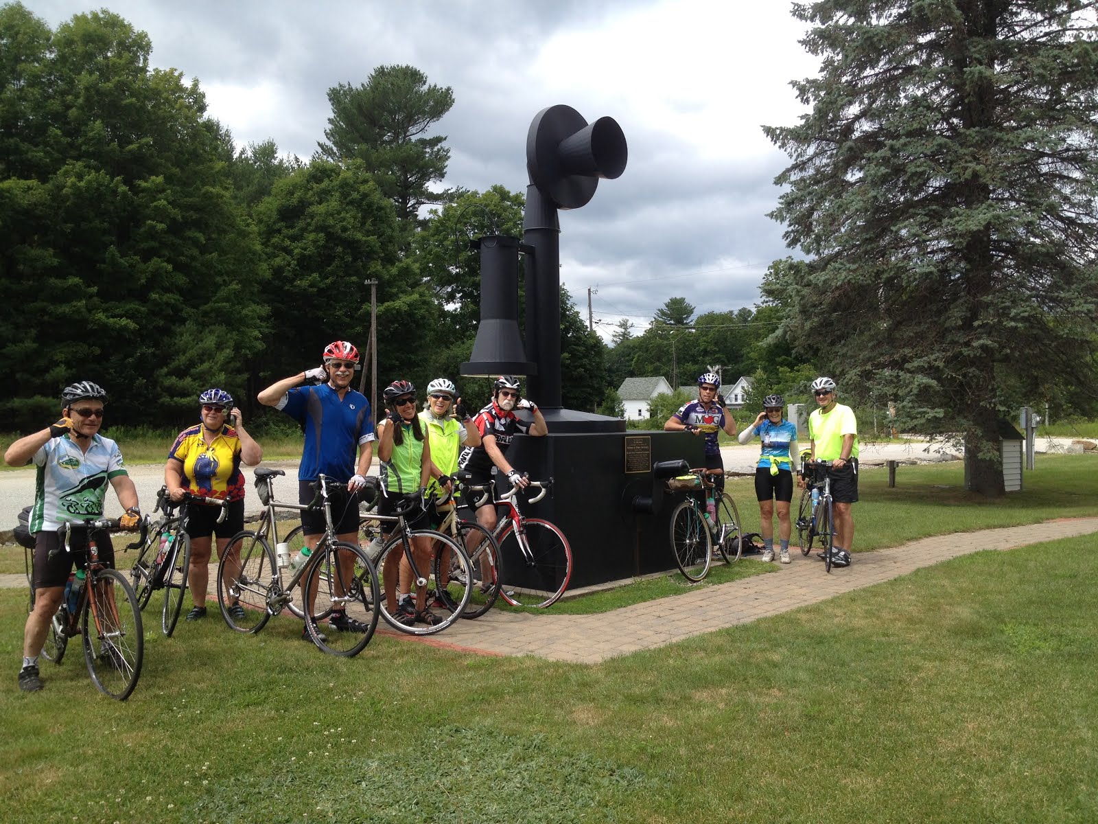
Kezar Lake Narrows
Thursday September 9th
I am off to Montreal to ride so I am going to set up the Thursday ride and hope that the weather holds for you this week!
How about the old favorite Kezar Lake Narrows Loop? So many of you know this ride that I am certainly not needed to point out the route! There are many options for this route, so make up a new version if you like!!!
Start the ride at the park next to the North Fryeburg Fire Station (as you know, park away from the fire station where the firefighters may need to park).
Ready to ride at 9:00 am.
The ride goes through the turf, potato and corn fields via Cornshop, Fish and McNeil, cross the Red Iron Bridge, up Union Hill Road. Check out the progress of the potatoes, corn, soybeans and grass. Look for llamas and horses and goats. For an option, turn left at Meadow Road (also known as New Road) and enjoy the new pavement to the Stow Store. Load up on goodies there and take them with you back over Meadow Road, back to Union Hill where you hang a left and head out (and gradually up) and over (bearing right at forks in the road) to the Kezar Lake Narrows. Just before the steel lattice bridge at the Narrows and before the snack shop at the Narrows is a narrow road leading to a shady narrow picnic area on the narrow part of the lake. Porta potties are there, too (narrow ones, likely..). Return is is by Christian Hill Road to Lovell and then a short ride on Route 5 to Shave Hill Road and back onto Harbor Road to the parking area. Be sure to stop and enjoy the views before dropping down into Lovell.
Total ride is 30 miles if you include the spur to The Stow Store. Cut out about 4 miles if you do not do the Stow Store.
Shorter option? Just do the route as mapped to the Stow Store and return by heading south on Rt 113 for about a 16 mile ride that is very flat for around here. Be ready to ride at the parking area at 9:00 am
As always, this ride includes the Red Iron Bridge (spanning the Old Saco River at the McNeil Road-Harbor Road intersection) which will be taken down later this fall or early next spring. So be sure to give it a salute and a kiss as you ride over it for its 53 years of service. The bridge over the Charles River on Harbor Road was under construction last time I was over there.
Map:
Wednesday, September 1, 2010
Shade, Short and Early
Thursday, September 2nd
Sorry for the late posting -- I just returned from some very nice and very flat riding in northwestern Vermont, both road riding and rail trail riding with the Fat Tire Cruisers. It is really nice riding out there -- but it was really hot!!
It is going to be hot and humid again tomorrow so I think a short, shady, early morning ride is the plan. This ride is yet another version of the Beautiful Brownfield Ride - but avoids the steep set of hills over in the Denmark area on the far side of the Saco River. There are ways to lengthen or shorten this ride if you like.
Meet: Maine Visitors Center, Fryeburg. It is on the right, just over the NH border on Route 302.
Time: Ready to ride at 8:30 am
Distance = 32 miles
Route: From the Visitors Center, take Haleytown Road about 5.5 miles to the intersection with Hampshire Rd. Take a left and ride to the intersection with Route 113. Cross over Route 113 and head out Route 160 for about 1.5 mile and bear left onto Lord Hill Road. At the end of the road at the T, take a LEFT. We typically take a Right and encounter a few steep hills, but considering the heat, take the left for a pleasant ride out and around until the road turns to dirt.
(To shorten the ride by 9 miles, just go to Route 113, do not cross -take a right, then another immediate right onto Pig St and follow the route as described below from Pig St.)
Turn back at the dirt road and reverse the route back to route 113. Turn left onto 113 for about 100 yards, then right again on Pig Street (flattest road in town), back to Hampshire (also called Main Street), then bear left onto Merrill Corner Road (NOT Dugway Road. Merrill Corner is after Dugway, just before crossing a bridge). This is a gradual uphill grade should be in the shade. Shorten the ride about 5 miles by staying on Hampshire and riding back to Haleytown -- but you miss the views!).
Turn left onto Old County Road for another gradual climb, then a right onto Sam Brown Hill Road. Enjoy the view and the downhill! Right onto Porter, right onto Hampshire (at the bottom of Asparagus Hill! Smile, you won't be climbing it!), then left back onto Haleytown to the parking lot.
Here is the map:
Subscribe to:
Posts (Atom)