Tuesday, September 30, 2014

Fall Colors in the Jefferson Valley 10:00 am

Thursday, October 2, 2014

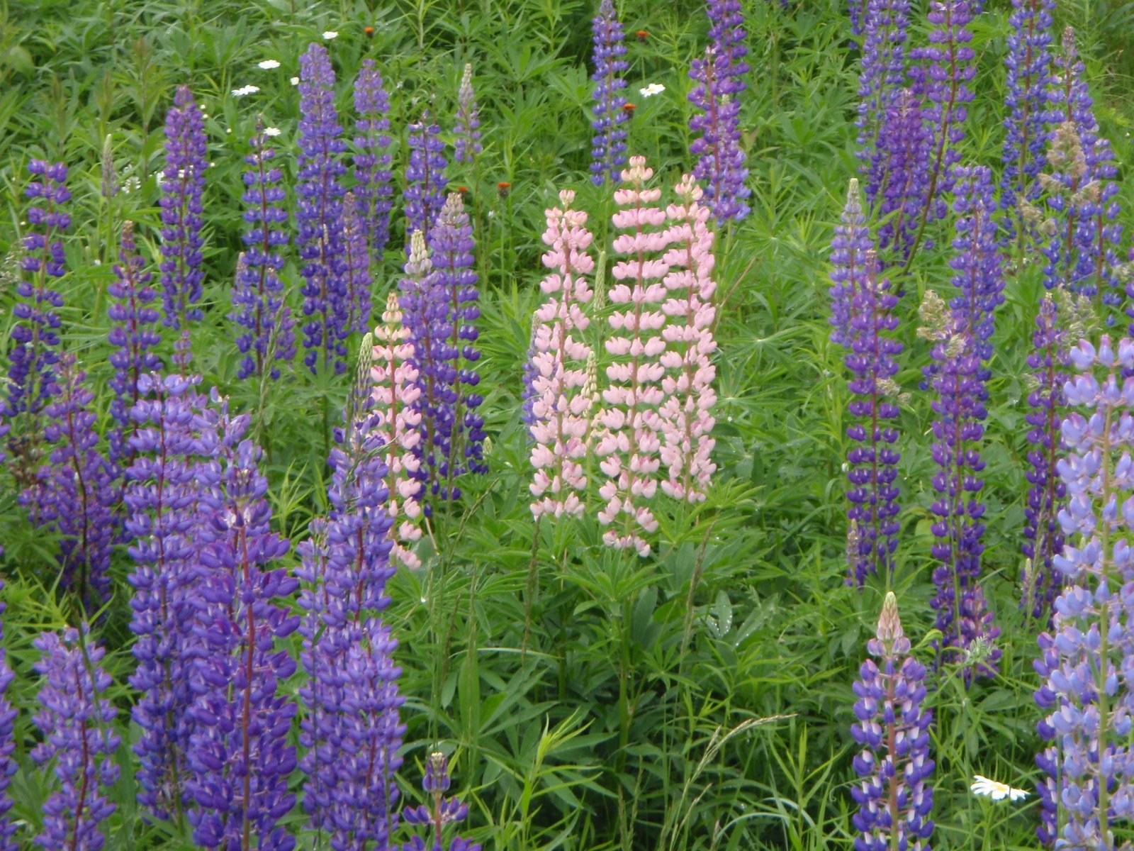
The colors are out, so here is a bike ride that I think provides a great fall foliage panoramas. This is a fall version of The Lupine Ride, with great views of the Presidentials, Wambek and Cherry Mountain. It is an easier ride than most, lots of flat roads and no big climbing. 

Start time: 10:00 am ready to ride 


Bring lunch or snacks. 


Meet at the parking lot on the west (Randolph) end of Pinkham B Road at the rail trail crossing. 


Carpool: Meet at the Jackson Ski Touring/Wentworth Golf Club parking area across the street from the J-Town Deli at 9:15 am.

Ride length: 28 miles, with a 22 mile option if you don't ride the route 115-115A triangle and just go to the campground on Israel River Road. 34 miles if we add the Jefferson loop. 

Route description: Cross Route 2 over to Durand Road. Ride it all the way up to the end of the dead end and walk the path up to Route 2. Ride about 2 miles and take a left onto Valley Road. Ride out Valley to Route 115. Take a left and ride up to the intersection with Cherry Mountain Road (on left) and Route 115A (on right). For something different and more views, take a LEFT onto Cherry Mountain Road. Ride out and back, soak up the views on the flat road, turn back where the road goes uphill. Return to Route 115, cross over it onto Route 115A and ride this out past the raircar home and cemeteries to the dairy farm in the Jefferson Valley. If Whipple Road's packed dirt is in good shape, we can ride it to Route 116 and make a loop through Jefferson.  Return to the Israel River valley, stop at the campground for lunch. The store there is closed on Thursday, but we could use the picnic tables there, or eat by the pond next to the campground. Head back by Valley Road then choose either Route 2 or Durand Road for the smiling downhill back to Pinkham B. 

Directions to the start: The start is at the Randolph end of the Pinkham B Road. There is parking right next to where the Presidential Rail Trail crosses Pinkham B. Access Pinkham B road from the Dolly Copp Campground entrance off of Route 16. As you drive down the hill on Pinkham B and come out of the woods, where there are 2 houses on the left, the rail trail crosses the road at a public works department building. There is parking on the left side near the rail trail.

If you don't want to drive Pinkham B's dirt and "pavement", drive route 16 to Gorham, follow it left at the intersection towards Berlin and then take a left on Route 2 at the traffic light. Go up the big hill and down the other side. Just as the hill flattens, Pinkham B Road will be on your left. Take the left and drive about 0.5 mile to the parking area near the rail trail on the right.


For a map:
http://www.mapmyride.com/routes/view/18419892
Monday, September 22, 2014

Apple Acres Orchard and Denmark Obelisk 10:00 am

Thursday May 26th, 2016

Thursday looks like a great day for a bike ride!!

Dave and Connie created this ride a few years ago and everyone loved it!  It should be a beautiful ride this week, especially now that the pastures are emerald green and the apple trees are blooming (and the lilacs, too!).

Start the ride from the Brownfield Community Center, head to Route 160 via Pig Street, turn left on Tripptown Road, left on Durgintown Rd. Stop at Apple Acres for the view, the ice cream and the apple blossoms!!  Continue downhill and turn left on scenic River Rd to Hiram.  Take a right onto Route 117 and ride to the Obelisk in the center of Denmark. Take a left onto Route 160 and head back to the Community Center.


Ready to Ride at 10:00 am.

Distance is about 35 miles. 

Meet at the Brownfield Community Center, 10:00 am. To drive there from the Conway area, take Route 302 just over the border into Maine, take a right onto Haleytown Road to the stop sign, then left onto Hampshire. Bear left at the Y junction with Route 160, the community center will be a short distance on your right. 


Carpool if you like, from the back of Grant's parking lot, 9:00 am. 

For the map, check www.ridewithgps.com. The ride is called "Apple Acres and Denmark Obelisk Loop".

Wednesday, September 17, 2014

The Basin 10:00 am

Thursday, September 18, 2014

Looks like a beautiful day for a ride to The Basin!

Sorry for the late post.... I have houseguests and we have been out and about. I will not be able to join you for The Basin tomorrow.

Meet at the corner of South Chatham Road and Route 113 in North Fryeburg, alongside the park next to the Saco Valley Fire Station. As you already know, please do not block the fire station parking area. Park head-in alongside the park to allow for many cars to fit in, or park parallel, off the road, along South Chatham Road or Rt 113.

The last quarter mile up to The Basin is a dirt road, and I am not sure of its condition at this point of the season. If it is a wash out, you may want to just use the campground at the entrance as your lunch spot. There are picnic tables, porta-potty and water pump in the campground. There is another campground with water and porta potties up at The Basin.

The starting time, ready-to-ride will be 10:00 am.

If you do the ride starting south on 113 and take a left on Fish St and left on MacNeil, it will be a 28 mile ride.

Carpoolers from the Bartlett/Jackson area -- meet at back end of Grants parking lot at 9:10 am. 


Wednesday, September 10, 2014

Rainy Day

Thursday, September 11, 2014

I just don't like the forecast for this Thursday. I am going to be grateful for this very long stretch of  summertime ThursdayBike that we have had, and just cave into the rain for tomorrow. So, the ride is cancelled, and I look forward to good weather for next week!


Tuesday, September 2, 2014

Bethel to Andover, Rivers and Fields 9:30 am

Thursday, September 4th, 2014

Looks like a beautiful day for a great ride along the rivers and fields of western Maine!

The route to Andover from Bethel is a beautiful ride on quiet roads. 

Start at the park (where we picnic on the North Road ride) on the Androscoggin River in Bethel and go north on Intervale Road to where it ends at Route 232 in Rumford Corner.  Take a left and cross the Androscoggin River on an old iron bridge, then another left onto Route 2 and shortly afterwards, a right onto Whippoorwill Road.

At the end of Whipporwill, go left onto Andover Road, then turn right onto East Andover Road, taking another right onto Covered Bridge Road and climb a short hill. (left, left, right, left, right, right!  Check the map!) All these manoevers keep you on the eastern side of the Ellis River. You will finally cross the Ellis a mile before arriving at the Andover Town Green, complete with a gazebo, and general store.    Great lunch stop!
Return via the western side of the Ellis river on Route 5, take a left to cross the Lovejoy covered bridge (Maine's shortest covered bridge) then retrace the route back to the cars via Covered Bridge Road, East Andover Road, Andover a Road, Whippoorwill and Intervale Road.    


Total distance: 49 miles

Shorter Option:  


Rumford Corner to Andover and back by Whipporwill Road and back via Route 5 is about 25 miles. Park at the intersection of route 2 and route 5 on the side of the Ellis river. There is a small parking area on the right side of route 2 at this intersection just before the bridge over the Ellis. Ride east on route 2 a short distance and take a left onto Whipporwill to join the ride.

Starting Time9:30 am Ready To Ride from the riverside park at the end of the bike path in Bethel on Route 26 (our usual lunch stop with picnic tables, porta-potties and playground).

Parking: There are not a lot of parking spaces at the riverside park! If the lot is full, you can park along Main Street in Bethel, also there is parking near the convenience store/DunkinDonuts on Route 2 right at where the bike path crosses the river.


Carpool: Meet at the parking lot across from the J-Town Deli at 8:20 am. 


To see a map of the ride click the link:


http://www.mapmyride.com/routes/view/9696224