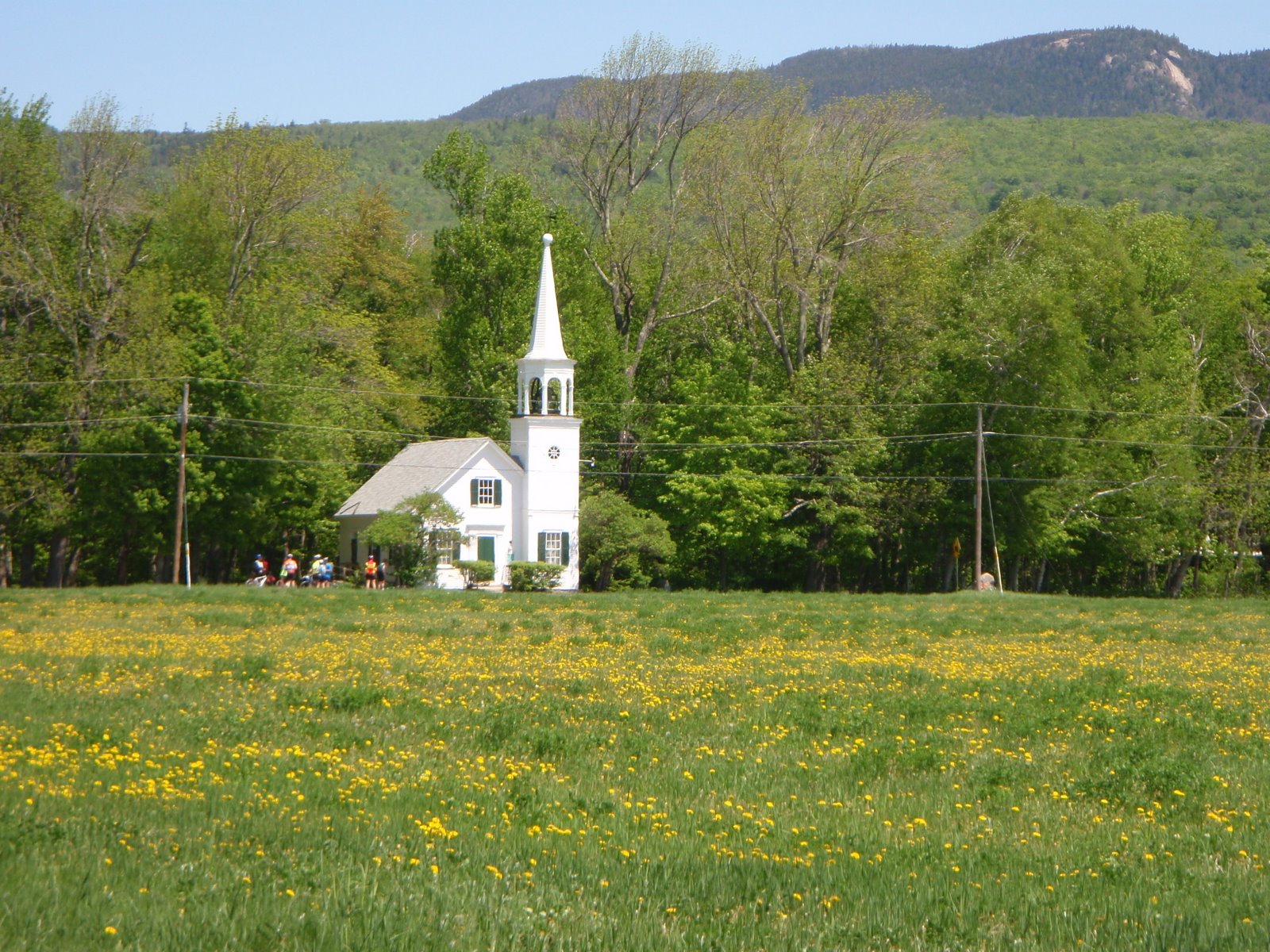
Anyone still want to ride?
How about a short, close to home ride? It is hard to put the bike away when we can't ski.
West Side Road - Passaconaway Road
Start at the public parking lot behind the Eastern Slope Inn.
Ready to Ride at 11:00 am
About 22 miles to the Albany Covered Bridge and back, 25 miles round trip to Lower Falls on the Kanc.
Showing posts with label 2011 Season. Show all posts
Showing posts with label 2011 Season. Show all posts
Wednesday, November 16, 2011

Wednesday, November 9, 2011
Ride Cancelled for Thursday, November 10th
So its back to the rain on Thursday routine.
Oh well, not a problem. We certainly have had good weather for a long time -- since the snowstorm! Everyone has probably been outside everyday biking, hiking, hauling and stacking wood, raking, garden clean-up -it's time for a day off!
Check the Velo club blog - the weather may be good for a ride on Saturday or Sunday!
Oh well, not a problem. We certainly have had good weather for a long time -- since the snowstorm! Everyone has probably been outside everyday biking, hiking, hauling and stacking wood, raking, garden clean-up -it's time for a day off!
Check the Velo club blog - the weather may be good for a ride on Saturday or Sunday!
Tuesday, November 1, 2011
Conway Village, Kanc and Passaconaway Loop 10:30am
THURSDAY, November 3rd, 2011
Yeah, here we go November - looks like the ThursdayBike can ride again!!
OK, so let's do an easy fun ride to get the ThursdayBikers back in the saddle!!
Start in Conway Village, at the parking lot behind the bank at the corner of Route 16 and Route 153 - behind Mountain Center Physical Therapy. Ready to ride at 10:30 am.
We ride out of the parking lot across the river on a footbridge then on the south side of Pequaket Pond. There is a short section (0.2 mile) of walkable dirt road, then cross over to Route 16 for a short ride to the Kanc. We can ride up the Kanc as far as we like - perhaps to the Covered Bridge, maybe to Lower Falls or Rocky Gorge - riders can decide depending on temperature. There should be very little traffic! The return is that great ride down Passaconway Road, then to West Side Road back to the parking lot.
Distance? Could be 23 miles, or 25 miles or 29 miles depending on how far up the Kanc we go.
Bring lunch or snacks. A headband or lightweight skullcap is useful to keep the ears warm.
Yeah, here we go November - looks like the ThursdayBike can ride again!!
OK, so let's do an easy fun ride to get the ThursdayBikers back in the saddle!!
Start in Conway Village, at the parking lot behind the bank at the corner of Route 16 and Route 153 - behind Mountain Center Physical Therapy. Ready to ride at 10:30 am.
We ride out of the parking lot across the river on a footbridge then on the south side of Pequaket Pond. There is a short section (0.2 mile) of walkable dirt road, then cross over to Route 16 for a short ride to the Kanc. We can ride up the Kanc as far as we like - perhaps to the Covered Bridge, maybe to Lower Falls or Rocky Gorge - riders can decide depending on temperature. There should be very little traffic! The return is that great ride down Passaconway Road, then to West Side Road back to the parking lot.
Distance? Could be 23 miles, or 25 miles or 29 miles depending on how far up the Kanc we go.
Bring lunch or snacks. A headband or lightweight skullcap is useful to keep the ears warm.
Thursday, October 27, 2011
FridayBike, Friday, October 28th
Ride the New Bike Path and out to the Stow Store 11:00
Looks like sunshine for Friday, but in the forties and breezy. So, not bad compared to most Thursdays we've had. Use the cross country ski clothes to stay comfortable.
For anyone who can ride on Friday: Meet at the Maine Visitors Center in Fryeburg on Route 302, ready to ride at 11:00. The sun might feel warm by then!
We can ride out the new bike path - the "Mountain Division Rail Trail" from the Visitor Center parking lot then cross over route 302 to 113 and ride out through North Fryeburg to the Stow Store.
Total miles? About 23 to 30, depending on the riders choice of routes and the weather!
Carpool from Glen or Jackson?? Meet at the Grants parking lot in Glen at 10:15
Looks like sunshine for Friday, but in the forties and breezy. So, not bad compared to most Thursdays we've had. Use the cross country ski clothes to stay comfortable.
For anyone who can ride on Friday: Meet at the Maine Visitors Center in Fryeburg on Route 302, ready to ride at 11:00. The sun might feel warm by then!
We can ride out the new bike path - the "Mountain Division Rail Trail" from the Visitor Center parking lot then cross over route 302 to 113 and ride out through North Fryeburg to the Stow Store.
Total miles? About 23 to 30, depending on the riders choice of routes and the weather!
Carpool from Glen or Jackson?? Meet at the Grants parking lot in Glen at 10:15
Wednesday, October 26, 2011
FridayBike?
The weather forecast for Thursday, October 27th is AGAIN not great for a bike ride. Wet snow this time...?! What next???
I am going to check the Friday weather forecast again tomorrow morning to see if FRIDAY will be OK for a ride. It could be OK, but cold. If the roads are not wet, the sun is out and the wind is light it may be OK for a ride. So, if you would like to get out for a ride on Friday, check this blog again tomorrow.
There is an eerie consistency to this ThursdayBike weather. Eventually, this weather pattern will change, and it is likely we will have a November full of perfect sunny Thursdays!!! (we had this 2 years ago!).
The last Bluebird ThursdayBike day was August 18th (The Basin). Thursday August 25th had 6 riders, and it started to rain about a half hour AFTER we finished the ride.
Then there was Tropical Storm Irene with the road closures, but we put together a great ride on Sept 1st with the The Bear Notch Loop (6 riders).
August 8th was not great weather I am not sure if anyone showed up!
The next 3 ThursdayBike rides were cancelled due to rain.
On October 6th, 6 riders did the Whitefield ride - cold and windy to start but a nice day eventually.
October 13th was cancelled, the 20th was cancelled (but FridayBike was a success for 6 riders!).
In the mean time, I might just take the storage wax off the rock skis.....
I am going to check the Friday weather forecast again tomorrow morning to see if FRIDAY will be OK for a ride. It could be OK, but cold. If the roads are not wet, the sun is out and the wind is light it may be OK for a ride. So, if you would like to get out for a ride on Friday, check this blog again tomorrow.
There is an eerie consistency to this ThursdayBike weather. Eventually, this weather pattern will change, and it is likely we will have a November full of perfect sunny Thursdays!!! (we had this 2 years ago!).
The last Bluebird ThursdayBike day was August 18th (The Basin). Thursday August 25th had 6 riders, and it started to rain about a half hour AFTER we finished the ride.
Then there was Tropical Storm Irene with the road closures, but we put together a great ride on Sept 1st with the The Bear Notch Loop (6 riders).
August 8th was not great weather I am not sure if anyone showed up!
The next 3 ThursdayBike rides were cancelled due to rain.
On October 6th, 6 riders did the Whitefield ride - cold and windy to start but a nice day eventually.
October 13th was cancelled, the 20th was cancelled (but FridayBike was a success for 6 riders!).
So, for 10 weeks, we had 6 cancellations, one beautiful day and 3 marginal days and one FridayBike.
Well, I hope we get to ride a few more times before the end of the ThursdayBike season! See you perhaps on Friday or for the Saturday Velo Club Ride!
In the mean time, I might just take the storage wax off the rock skis.....
Wednesday, October 19, 2011
FridayBike!
Friday, October 21st, 2011
North Road to Evans Notch
OK, I have had enough of this rain on Thursdays!!
Since this Thursday is again plagued by rain, I am going to get around this by setting up the ride for Friday this week....
Riding in the fall foliage is just so nice that I want to be out there a few more times before the colors disappear!
For anyone who can ride on Friday, let's do the North Road-Evans Notch Ride. We have not done this ride for more than a year. It is a pleasant easy ride! It is now improved since the short section on Route 2 is now a newly paved very wide shoulder. Riding up towards Evans Notch alongside the Wild River is very interesting after the damage caused by Tropical Storm Irene.
The ride starts out of the dirt parking area at the North Road-Hogan Road intersection. Ride North Road to the iron bridge (Bridge Street, about 9 miles), take a right to cross the bridge and ride up to Route 2. Take a right, then after about 0.3 mile, take a left onto Route 113 which goes up Evans Notch. The Wild River is very visible now after the flooding, and the suspension bridge that we used to walk across was destroyed by the raging river. We can stop to see what remains. The ride up towards the notch is a beautiful, flat to very gradual climb for about 8 miles. At this point, at a small bridge, the climb steepens for about a mile to the top of the notch.
Round trip to the beginning of the steeper climb at the small bridge and back is 32 miles.
Longer ride: Round trip to the top of the notch, if you want to do it, is about 36 miles.
Shorten the ride to about 18 miles if you start at the iron bridge on Bridge Street, parking in the canoe/kayak parking area on the south west side of the bridge.
We can pick a spot along the river in the sun for lunch or snacks.
How to get there:
Take Route 16 through Pinkham Notch to Gorham. Take a right onto Route 2 and drive about 3 miles. Just after a beautiful stone house and barn on the left, take a left onto North Road. Cross the dam, notice the damage from Irene, then continue 0.2 mile to the intersection with Hogan Road to park at the corner.
Ready to ride FRIDAY at 10:00am
Carpool? Meet in the parking lot across the street from the J-Town Deli in Jackson at 9:15.
Check the blog again on Friday morning if the rain decides to plague FridayBike.....
North Road to Evans Notch
OK, I have had enough of this rain on Thursdays!!
Since this Thursday is again plagued by rain, I am going to get around this by setting up the ride for Friday this week....
Riding in the fall foliage is just so nice that I want to be out there a few more times before the colors disappear!
For anyone who can ride on Friday, let's do the North Road-Evans Notch Ride. We have not done this ride for more than a year. It is a pleasant easy ride! It is now improved since the short section on Route 2 is now a newly paved very wide shoulder. Riding up towards Evans Notch alongside the Wild River is very interesting after the damage caused by Tropical Storm Irene.
The ride starts out of the dirt parking area at the North Road-Hogan Road intersection. Ride North Road to the iron bridge (Bridge Street, about 9 miles), take a right to cross the bridge and ride up to Route 2. Take a right, then after about 0.3 mile, take a left onto Route 113 which goes up Evans Notch. The Wild River is very visible now after the flooding, and the suspension bridge that we used to walk across was destroyed by the raging river. We can stop to see what remains. The ride up towards the notch is a beautiful, flat to very gradual climb for about 8 miles. At this point, at a small bridge, the climb steepens for about a mile to the top of the notch.
Round trip to the beginning of the steeper climb at the small bridge and back is 32 miles.
Longer ride: Round trip to the top of the notch, if you want to do it, is about 36 miles.
Shorten the ride to about 18 miles if you start at the iron bridge on Bridge Street, parking in the canoe/kayak parking area on the south west side of the bridge.
We can pick a spot along the river in the sun for lunch or snacks.
How to get there:
Take Route 16 through Pinkham Notch to Gorham. Take a right onto Route 2 and drive about 3 miles. Just after a beautiful stone house and barn on the left, take a left onto North Road. Cross the dam, notice the damage from Irene, then continue 0.2 mile to the intersection with Hogan Road to park at the corner.
Ready to ride FRIDAY at 10:00am
Carpool? Meet in the parking lot across the street from the J-Town Deli in Jackson at 9:15.
Check the blog again on Friday morning if the rain decides to plague FridayBike.....
Wednesday, October 12, 2011
Thursday, the 13th
October 13th, 2011
It's Thursday the 13th, and the the unlucky forecast has a 90% chance of rain. It is really hard not to be doing Thursday rides in the fall foliage. I am getting sick of cancelling rides....!!
Hopefully next week will be spectacular!
On Friday, the 14th, at 3:00, there will be a Gala Grand Opening of the bike path which starts at the Fryeburg, ME Visitor Center on Route 302. This is known as "The Kinsman Trail" by the locals, in honor of all the work Dave Kinsman has done to get the Mountain Division Rail-With-Trail system going! The 1.5 mile path is paved and will be enjoyed by many! If it isn't raining, meet there for a ride on the path at 3:00.
It's Thursday the 13th, and the the unlucky forecast has a 90% chance of rain. It is really hard not to be doing Thursday rides in the fall foliage. I am getting sick of cancelling rides....!!
Hopefully next week will be spectacular!
On Friday, the 14th, at 3:00, there will be a Gala Grand Opening of the bike path which starts at the Fryeburg, ME Visitor Center on Route 302. This is known as "The Kinsman Trail" by the locals, in honor of all the work Dave Kinsman has done to get the Mountain Division Rail-With-Trail system going! The 1.5 mile path is paved and will be enjoyed by many! If it isn't raining, meet there for a ride on the path at 3:00.
Wednesday, October 5, 2011
White Mountains and Whitefield in Full Color 10:00 am
Thursday, October 6th, 2011
Since the Velo Club Saturday Ride was cancelled due to rain, let's do the ride that was scheduled!!
The sun will be shining but the temperature will be the coolest since last spring, so dress warmly...
I have ordered a tail wind for the way back to the car. I will not be able to join you for this ride, I am in CT, but I will try to ride there.
Here is the ride as was posted on the Velo Website:
Because of the cool (cold?) temperature, let's start at 10:00 am
It's Leaf Peeping Time - time to do the bike rides that are saved for the best panoramic views of the brilliant foliage. Let's head out to ride on the other side of Crawford Notch, where the foliage is probably peak right now.
The ride starts out of the Eisenhower Wayside Park, on the right side of Route 302 about 2 miles after passing through Crawford Notch/Highland Center. Ride west to the Twin Mountain 4-corners, take a right onto Route 3. Take another right onto Route 115. After passing the scenic vista/parking area on the left, take a left onto Airport Road/Hazen Road and ride down past the Pondicherry Wildlife Refuge, the airport and industrial center. Cross the RR tracks and take a right. Cross the tracks again and ride to Route 116 and take a left to go into Whitefield Center. The lunch stop is on the town green at the gazebo. There is a convenience store, an ice cream store and Dunkin Donuts close by. Return by the same route - but enjoy a completely different panoramic view!
Ready to ride at 10:00 am
Carpool from Grant's parking lot, in the back near the Mountain Center Physical Therapy at 9:15 am
Distance from Eisenhower Wayside: 39 miles
Shorter options:
Start at the parking lot (right side of 302) near the Zealand Road/ and Zealand Campground: 30 miles
Start at the Twin Mountain Visitor Center at the gazebo at the light at the Route 302/3 intersection: 25 miles
Here is a link to the map:
http://www.mapmyride.com/routes/view/40208406
Since the Velo Club Saturday Ride was cancelled due to rain, let's do the ride that was scheduled!!
The sun will be shining but the temperature will be the coolest since last spring, so dress warmly...
I have ordered a tail wind for the way back to the car. I will not be able to join you for this ride, I am in CT, but I will try to ride there.
Here is the ride as was posted on the Velo Website:
Because of the cool (cold?) temperature, let's start at 10:00 am
It's Leaf Peeping Time - time to do the bike rides that are saved for the best panoramic views of the brilliant foliage. Let's head out to ride on the other side of Crawford Notch, where the foliage is probably peak right now.
The ride starts out of the Eisenhower Wayside Park, on the right side of Route 302 about 2 miles after passing through Crawford Notch/Highland Center. Ride west to the Twin Mountain 4-corners, take a right onto Route 3. Take another right onto Route 115. After passing the scenic vista/parking area on the left, take a left onto Airport Road/Hazen Road and ride down past the Pondicherry Wildlife Refuge, the airport and industrial center. Cross the RR tracks and take a right. Cross the tracks again and ride to Route 116 and take a left to go into Whitefield Center. The lunch stop is on the town green at the gazebo. There is a convenience store, an ice cream store and Dunkin Donuts close by. Return by the same route - but enjoy a completely different panoramic view!
Ready to ride at 10:00 am
Carpool from Grant's parking lot, in the back near the Mountain Center Physical Therapy at 9:15 am
Distance from Eisenhower Wayside: 39 miles
Shorter options:
Start at the parking lot (right side of 302) near the Zealand Road/ and Zealand Campground: 30 miles
Start at the Twin Mountain Visitor Center at the gazebo at the light at the Route 302/3 intersection: 25 miles
Here is a link to the map:
http://www.mapmyride.com/routes/view/40208406
Tuesday, September 27, 2011
Rain Rain Go Away!
Can you choose a Different Day?
(but not Tuesday, Wednesday, Friday or Saturday...)
Thursday, September 29, 2011
Ride Cancelled, again.
Again, all the forecasts seem to agree on rain for this Thursday, again. The exact timing of the rain is difficult to determine, but I think it is just not worth trying to plan a ride.
I really hope for good weather for next Thursday - the foliage should be peak, and we are going to ride in it!!
(but not Tuesday, Wednesday, Friday or Saturday...)
Thursday, September 29, 2011
Ride Cancelled, again.
Again, all the forecasts seem to agree on rain for this Thursday, again. The exact timing of the rain is difficult to determine, but I think it is just not worth trying to plan a ride.
I really hope for good weather for next Thursday - the foliage should be peak, and we are going to ride in it!!
Wednesday, September 21, 2011
Thursday, September 22, 2011
Once Again, Weather Cancels the Ride
I am disappointed to cancel the ride yet again. Looks like the weather will be wet for the next few days (week?)... but it will be warm...
I hope everyone has been out to enjoy the beautiful, sunny, early fall-like days over the past week or two. Unfortunately these great days have not been in sync with the group bike ride schedule so far this September.
Let's hope for spectacular weather once this slow moving low pressure system finally exits!
I am disappointed to cancel the ride yet again. Looks like the weather will be wet for the next few days (week?)... but it will be warm...
I hope everyone has been out to enjoy the beautiful, sunny, early fall-like days over the past week or two. Unfortunately these great days have not been in sync with the group bike ride schedule so far this September.
Let's hope for spectacular weather once this slow moving low pressure system finally exits!
Wednesday, September 14, 2011
Thursday, September 15
RIDE CANCELLED due to the drizzle and expected rain.
See you next week for a good ride!!
West Side Road-Passaconaway Road, Rocky Gorge 9:30
I am sorry to be posting the ride so late. I just got in the door, returning from riding the Route Verte in Quebec...A Great Place to Ride!
Since I am not sure of the weather situation here, how about a local ride again - just the usual on West Side Road to Passaconaway, and, if the weather is OK, ride up to Rocky Gorge. To the bridge and back is about 24 miles. To Rocky Gorge it is about 30 miles.
Let's meet at the public parking lot behind the Eastern Slope Inn at 9:30 (it might be cool in the morning), ready to ride.
See you next week for a good ride!!
West Side Road-Passaconaway Road, Rocky Gorge 9:30
I am sorry to be posting the ride so late. I just got in the door, returning from riding the Route Verte in Quebec...A Great Place to Ride!
Since I am not sure of the weather situation here, how about a local ride again - just the usual on West Side Road to Passaconaway, and, if the weather is OK, ride up to Rocky Gorge. To the bridge and back is about 24 miles. To Rocky Gorge it is about 30 miles.
Let's meet at the public parking lot behind the Eastern Slope Inn at 9:30 (it might be cool in the morning), ready to ride.
Wednesday, August 31, 2011
Bear Notch Road from Attitash, 9:00 am
Thursday, September 1, 2011
Wednesday, 4:00 pm update:
I rode River Road, Passaconaway Road and the Kanc to Lower Falls this afternoon. All are open and clear - a few sandy spots and a few small sticks here and there. A Forest Service Ranger at Lower Falls told me that Bear Notch Road is now open, and the Kanc is open from Conway Village up to Bear Notch Road.
The plan as described below is still on, as the roads are eerily quiet since most folks haven't found out about the openings as of yet. So although the roads are open, the traffic will be very light.
Here is one more alternative to add to the list of ride alternatives below: The Bear Notch Loop.
Hurricane Irene has changed the course of rivers, washed away houses and camps, eroded roadsides and pavement and collapsed bridges. I hope all of you, ThursdayBikers and your friends, are dry and OK. Because of the road damage and closures, I am keeping the ride local on roads that I have heard are clear.
Due to the closure of the Kanc and Route 302 west of Bartlett, there are no cars on Bear Notch Road. Riders who did it on Tuesday said it was excellent without any cars and it is free of debris. Let's go enjoy this too! This is one of the easiest "Notches" and it has 3 scenic viewpoints (rest stops) conveniently located on the way up.
Ready to Ride at the Attitash parking lot at 9:00 am. Park at the west side of the lot in the shade of the trees.
Various distances are possible. Groups can choose their course:
From Attitash to the top of Bear Notch and back: about 15 miles
From Attitash, over Bear Notch to the Kanc and back about 23 miles
From the Bear Notch/Kanc intersection it may be possible to ride the Kanc (I am not sure whether it is closed from this point). If open we could go to the Sugar Hill scenic vista (34 miles round trip) or Lily Pond (37 miles round trip)
For the shortest, flattest ride, go from Attitash up to the road closure on Route 302 at Hart's Location (~10 miles).
Wednesday, 4:00 pm update:
I rode River Road, Passaconaway Road and the Kanc to Lower Falls this afternoon. All are open and clear - a few sandy spots and a few small sticks here and there. A Forest Service Ranger at Lower Falls told me that Bear Notch Road is now open, and the Kanc is open from Conway Village up to Bear Notch Road.
The plan as described below is still on, as the roads are eerily quiet since most folks haven't found out about the openings as of yet. So although the roads are open, the traffic will be very light.
Here is one more alternative to add to the list of ride alternatives below: The Bear Notch Loop.
Hurricane Irene has changed the course of rivers, washed away houses and camps, eroded roadsides and pavement and collapsed bridges. I hope all of you, ThursdayBikers and your friends, are dry and OK. Because of the road damage and closures, I am keeping the ride local on roads that I have heard are clear.
Due to the closure of the Kanc and Route 302 west of Bartlett, there are no cars on Bear Notch Road. Riders who did it on Tuesday said it was excellent without any cars and it is free of debris. Let's go enjoy this too! This is one of the easiest "Notches" and it has 3 scenic viewpoints (rest stops) conveniently located on the way up.
Ready to Ride at the Attitash parking lot at 9:00 am. Park at the west side of the lot in the shade of the trees.
Various distances are possible. Groups can choose their course:
From Attitash to the top of Bear Notch and back: about 15 miles
From Attitash, over Bear Notch to the Kanc and back about 23 miles
From the Bear Notch/Kanc intersection it may be possible to ride the Kanc (I am not sure whether it is closed from this point). If open we could go to the Sugar Hill scenic vista (34 miles round trip) or Lily Pond (37 miles round trip)
For the shortest, flattest ride, go from Attitash up to the road closure on Route 302 at Hart's Location (~10 miles).
Wednesday, August 24, 2011
West Side Road - Passaconaway Road 9:00 am
Thursday, August 25th, 2011
The weather looks a bit iffy for this week's ride. I don't think is is worth putting together an away adventure ride with the predictions of thunderstorms coming in as early as 1:00.
So, these are the times I pull out the old standby, the West Side Road - Passaconaway Road ride. It is local, out and back, it can be cut short if the weather threatens, and it is a really nice ride, too.
Let's meet at the public parking lot behind the Eastern Slope Inn at 9:00, ready to ride. The route out to the Albany Covered Bridge and back is about 25 miles. If the weather holds, we can go up to the Lower Falls on the Kanc.
All the weather-people are energized with the upcoming Hurricane Irene. It is very exciting to watch the development. Hold onto your hats this weekend. My Mom's name is Irene, and she is getting lots of attention this week....
The weather looks a bit iffy for this week's ride. I don't think is is worth putting together an away adventure ride with the predictions of thunderstorms coming in as early as 1:00.
So, these are the times I pull out the old standby, the West Side Road - Passaconaway Road ride. It is local, out and back, it can be cut short if the weather threatens, and it is a really nice ride, too.
Let's meet at the public parking lot behind the Eastern Slope Inn at 9:00, ready to ride. The route out to the Albany Covered Bridge and back is about 25 miles. If the weather holds, we can go up to the Lower Falls on the Kanc.
All the weather-people are energized with the upcoming Hurricane Irene. It is very exciting to watch the development. Hold onto your hats this weekend. My Mom's name is Irene, and she is getting lots of attention this week....
Tuesday, August 16, 2011
The Basin 9:00 am start
Thursday, August 18th, 2010
Looks like all the rain is going to end and provide a beautiful day for ThursdayBike! To get away from the amazing amount of traffic in the valley, let's do the Basin ride, on the quiet roads of North Fryeburg and Chatham. I will not be able to join in this Thursday - I am hiking with my 1st cousins, once removed.
Meet at the corner of South Chatham Road and Route 113 in North Fryeburg, alongside the park next to the Saco Valley Fire Station. As you already know, please do not block the fire station parking area. Park head-in alongside the park to allow for many cars to fit in, or park parallel, off the road, along South Chatham Road or Rt 113.
The last quarter mile up to The Basin is a dirt road, and I am not sure of its condition at this point of the season. If it is a wash out, you may want to just use the campground at the entrance as your lunch spot. There are picnic tables, porta-potty and water pump in the campground. There is another campground with water and porta potties up at The Basin.
The starting time, ready-to-ride will be 9:00 am.
If you do the ride starting south on 113 and take a left on Fish St and left on MacNeil, it will be a 28 mile ride.
Want more miles?? If you continue past Fish down to Cornshop and hang a left there and ride out to Rt 5 and take a left on Fish St, your total will be 33 miles. If you start earlier at Weston's Beach you get 44 miles.
Carpoolers from the Bartlett/Jackson area -- meet at Grants parking lot at 8:15.
Looks like all the rain is going to end and provide a beautiful day for ThursdayBike! To get away from the amazing amount of traffic in the valley, let's do the Basin ride, on the quiet roads of North Fryeburg and Chatham. I will not be able to join in this Thursday - I am hiking with my 1st cousins, once removed.
Meet at the corner of South Chatham Road and Route 113 in North Fryeburg, alongside the park next to the Saco Valley Fire Station. As you already know, please do not block the fire station parking area. Park head-in alongside the park to allow for many cars to fit in, or park parallel, off the road, along South Chatham Road or Rt 113.
The last quarter mile up to The Basin is a dirt road, and I am not sure of its condition at this point of the season. If it is a wash out, you may want to just use the campground at the entrance as your lunch spot. There are picnic tables, porta-potty and water pump in the campground. There is another campground with water and porta potties up at The Basin.
The starting time, ready-to-ride will be 9:00 am.
If you do the ride starting south on 113 and take a left on Fish St and left on MacNeil, it will be a 28 mile ride.
Want more miles?? If you continue past Fish down to Cornshop and hang a left there and ride out to Rt 5 and take a left on Fish St, your total will be 33 miles. If you start earlier at Weston's Beach you get 44 miles.
Carpoolers from the Bartlett/Jackson area -- meet at Grants parking lot at 8:15.
Also - in case you enjoy the downhill better than the uphill -- Joan Kelly is aranging a deal at Bretton Woods for their lift assisted mountain bike riding. She will get a discount for the Tuesday Fattire Crusiers gorup, next Tuesday, Aug 23rd, if she gets 12 people or more. She almost has enough...
Bring your own mountain bike or rent one there.
Contact her at chumley@earthlink.net for more info
See you there!!
Friday, July 29, 2011
Steve Swensen's Ride to Hiram and Cornish
Thursday, August 4, 2011
Steve Swensen will host the ride for this first Thursday of August. After the ride, he has invited everyone over to his lake house for a swim!
The ride will start out of the parking lot behind the convenience store/gas station at the Brownfield 5 corners where route 160 crosses route 113/5, near Pig Street. The ride will start at 9:30 am.
Steve's lake house is on Lovewell Pond, just north of the 5-corners, on the right side of Route 113/5 going north, turn onto Fire Lane 15, Cranberry Lane.
Here is a map:
http://www.mapmyride.com/routes/view/43730404
Steve Swensen will host the ride for this first Thursday of August. After the ride, he has invited everyone over to his lake house for a swim!
The ride will start out of the parking lot behind the convenience store/gas station at the Brownfield 5 corners where route 160 crosses route 113/5, near Pig Street. The ride will start at 9:30 am.
Steve's lake house is on Lovewell Pond, just north of the 5-corners, on the right side of Route 113/5 going north, turn onto Fire Lane 15, Cranberry Lane.
Here is a map:
http://www.mapmyride.com/routes/view/43730404
Wednesday, July 27, 2011
Don't Yank the Crank
Thursday, July 28th, 2011
Bethel to Bryant Pond, Maine
Looks like the weather will be great for a ride by the beautiful woods, farms and lakes of Maine!
This ride will take us from Bethel to Bryant Pond, the site of last hand-cranked telephone exchange in the USA. This little town is also famous for a 3-story outhouse. It also has a convenience store, a larger-than-life telephone monument and great lakeside dining.
But Wait... there's more!!!
The ride is nice and quiet, along the Androscoggin River (essentially a continuation of the North Road experience), fields, farms and forest plus shore side riding on North Lake in Locke Mills. No Notches! This will be a welcome relief from the traffic and noise around the Mt. Washington Valley in tourist season.
This ride starts out of the riverside park in Bethel -- the picnic destination on the North Road ride. The first 12 miles follows Intervale Road which parallels the Androscoggin River as it flows north towards Rumford. We turn east towards Bryant Pond, go through the village, try to find that famous outhouse, pay our respects at the Hand Crank Telephone Monument, then go to the lake for our picnic lunch. The return is by North Pond in Locke Mills, then by East Bethel Road (look for some interesting sculptures on the left), then back to the cars via Intervale Road.
The ride will start at 9:30 am at the Bethel town park on the Androscoggin River at the intersection of the bike path and Route 26 (where we always eat lunch on the North Road Ride).
Drive to Bethel via Route 2 and take a right on Bridge Street, at the flashing light (soon before crossing the bridge over the Androscoggin). Drive about 0.5 mile to the park, on the left at the stop sign.
Ride distance is 40 miles.
Ready to ride at 9:30 am!!
If you want carpool, meet at the Jackson Ski Touring/Wentworth Golf Club parking area across the street from the J-Town Deli at 8:15 am. Otherwise, see you in Bethel!
See map link at the bottom of this post...
Here is some info on Bryant Pond:
www.roadsideamerica.com/map/631
www.privateline.com/mt_telephonehistory/iv_the_telephone_evolves/07_part_g/
"Bryant Pond achieved some national fame and media attention beginning in the mid-1970s when its family-owned Bryant Pond Telephone Company became the last hand-crank telephone exchange in operation in the United States. When in 1981 the local company, operating from a two-position magneto switchboard in the living room of owners Barbara and Elden Hathaway, was purchased by the Oxford County Telephone & Telegraph Company, a nearby larger independent company. A movement called "Don't Yank The Crank" was organized by David Perham and Brad Hooper in a valiant but futile effort to keep their beloved crank phones. The effort was not ultimately successful, and the last "crank" calls took place on 11 October 1983, when a modern dial exchange was placed in service."
Here is a map of the ride: (I will bring maps for everyone)
http://www.mapmyride.com/routes/view/22002290
Bethel to Bryant Pond, Maine
Looks like the weather will be great for a ride by the beautiful woods, farms and lakes of Maine!
This ride will take us from Bethel to Bryant Pond, the site of last hand-cranked telephone exchange in the USA. This little town is also famous for a 3-story outhouse. It also has a convenience store, a larger-than-life telephone monument and great lakeside dining.
But Wait... there's more!!!
The ride is nice and quiet, along the Androscoggin River (essentially a continuation of the North Road experience), fields, farms and forest plus shore side riding on North Lake in Locke Mills. No Notches! This will be a welcome relief from the traffic and noise around the Mt. Washington Valley in tourist season.
This ride starts out of the riverside park in Bethel -- the picnic destination on the North Road ride. The first 12 miles follows Intervale Road which parallels the Androscoggin River as it flows north towards Rumford. We turn east towards Bryant Pond, go through the village, try to find that famous outhouse, pay our respects at the Hand Crank Telephone Monument, then go to the lake for our picnic lunch. The return is by North Pond in Locke Mills, then by East Bethel Road (look for some interesting sculptures on the left), then back to the cars via Intervale Road.
The ride will start at 9:30 am at the Bethel town park on the Androscoggin River at the intersection of the bike path and Route 26 (where we always eat lunch on the North Road Ride).
Drive to Bethel via Route 2 and take a right on Bridge Street, at the flashing light (soon before crossing the bridge over the Androscoggin). Drive about 0.5 mile to the park, on the left at the stop sign.
Ride distance is 40 miles.
Ready to ride at 9:30 am!!
If you want carpool, meet at the Jackson Ski Touring/Wentworth Golf Club parking area across the street from the J-Town Deli at 8:15 am. Otherwise, see you in Bethel!
See map link at the bottom of this post...
Here is some info on Bryant Pond:
www.roadsideamerica.com/map/631
www.privateline.com/mt_telephonehistory/iv_the_telephone_evolves/07_part_g/
"Bryant Pond achieved some national fame and media attention beginning in the mid-1970s when its family-owned Bryant Pond Telephone Company became the last hand-crank telephone exchange in operation in the United States. When in 1981 the local company, operating from a two-position magneto switchboard in the living room of owners Barbara and Elden Hathaway, was purchased by the Oxford County Telephone & Telegraph Company, a nearby larger independent company. A movement called "Don't Yank The Crank" was organized by David Perham and Brad Hooper in a valiant but futile effort to keep their beloved crank phones. The effort was not ultimately successful, and the last "crank" calls took place on 11 October 1983, when a modern dial exchange was placed in service."
Here is a map of the ride: (I will bring maps for everyone)
http://www.mapmyride.com/routes/view/22002290
Tuesday, July 19, 2011
Brownfield-Hiram Loop
Thursday July 21, 2011
Dave and Connie Kinsman have offered to host a ride. This will be new ride for ThursdayBike, and I think it will be new favorite!
Here is the ride description from Dave and Connie:
"Here is the ride we planned for Thursday. It's not too long because it sounds like the day will turn hot.
We will meet at the Community Center, formerly Brownfield School on Main Street in Brownfield (we always ride past it on our extended Brownfield ride) at 9:00am.
Turn right from the school and ride up Main Street to Route 113. Cross 113 onto Route 160 north. Follow 160 to the monument in Denmark. Turn right onto Route 117 south. Stop at the Hiram Store in Hiram village.
Continue to Route 113. Turn right and ride about 2 1/2 miles up 113 to Notch Road. There is a small shoulder along this stretch. Turn left on Notch Road and follow it about 6 1/2 miles to the end. Turn right on 160 north back into Brownfield. Turn right at the park to return to the school. This ride should be about about 34 miles."
David and Connie will try to be there early to direct parking. David will lead the ride and Connie will sweep.
Here is a link to a map :
http://www.mapmyride.com/routes/view/42272870
Dave and Connie Kinsman have offered to host a ride. This will be new ride for ThursdayBike, and I think it will be new favorite!
Here is the ride description from Dave and Connie:
"Here is the ride we planned for Thursday. It's not too long because it sounds like the day will turn hot.
We will meet at the Community Center, formerly Brownfield School on Main Street in Brownfield (we always ride past it on our extended Brownfield ride) at 9:00am.
Turn right from the school and ride up Main Street to Route 113. Cross 113 onto Route 160 north. Follow 160 to the monument in Denmark. Turn right onto Route 117 south. Stop at the Hiram Store in Hiram village.
Continue to Route 113. Turn right and ride about 2 1/2 miles up 113 to Notch Road. There is a small shoulder along this stretch. Turn left on Notch Road and follow it about 6 1/2 miles to the end. Turn right on 160 north back into Brownfield. Turn right at the park to return to the school. This ride should be about about 34 miles."
David and Connie will try to be there early to direct parking. David will lead the ride and Connie will sweep.
Here is a link to a map :
http://www.mapmyride.com/routes/view/42272870
Tuesday, July 12, 2011
North Road (let's try this again...) 9:00 am
Thursday, July 14th, 2011
The weather forecasters seem certain that Thursday will be a fantastic day, so I think it's worth trying to do the North Road ride (again).
Two weeks ago the rain turned (most of) us back to do a ride in North Fryeburg where the temperature was 10 degrees warmer, it was not raining and the sun was partially out. There was one who actually did the ride from the Gilead bridge to Bethel and did not get rained on. She wondered where we all were....
Let's start the ride at 9:00 am, summertime schedule.
Start at the intersection of North Road and Hogan Road, on the north side of the Androscoggin River, ready to ride at 9:00 am.
To get to this point, drive north over Pinkham Notch on Route 16. Turn right at the intersection with route 2 in Gorham. Drive about 3 miles, and turn left onto North Road, just after a beautiful stone house and barn. Cross the river at the dam, and proceed about 1/4 mile to where North Road bears sharply right. Hogan Road, a dirt road with access to several trailheads, comes in from the left, and there is a dirt parking area there. (Those of you from the Fryeburg area probably do best by driving up and over Evans Notch).
The entire ride on North Road to the picnic area alongside the river in Bethel, and back, is 39 miles. The ride is not difficult - it has a mix of flat sections, rolling hills, a few short granny gear climbs, lots of farm and mountain scenery and occasional views of the river.
Near the end, just before reaching Route 2/Route 5, there is a bike path that turns right at a red fire hydrant and goes behind the water slide park. The path goes for 1.1 miles, ending at a nice riverside picnic spot (and porta-potty).
Although there are many options for food in Bethel (including a convenience store on the bike path), it easiest to bring your own lunch.
Shorter Options:
Option 1. For the best shorter option, do the eastern (Bethel) portion of North Road. This starts at the Gilead bridge at a parking area for boaters. This option allows you to meet up with everyone and have lunch together at the riverside park. This is a 20 mile option. Drive to the Gilead steel trestle bridge (Bridge Street) via Route 2 (look for it on the left soon after the intersection with the road that goes over Evans Notch - after the new Route 2 bridge), park at the canoe parking area on the southwest side of the bridge, ride across the bridge and join the riders there as they ride by on North Road at about 9:45.
You could also drive from the Hogan Road parking area 9.3 miles down North Road where you will come to an intersection with the bridge on your right. Starting at the bridge and riding to Bethel will give you a 20 mile round trip. To lengthen this a bit, start earlier, cross the bridge, turn left and ride until you meet the riders coming from Hogan Road. Turn and join in with the group!
Option 2: If you wish to start at the Hogan Road parking area, you can ride out with the group and turn back when you've had enough:
To Shelburne and back is 10.2 miles round trip
To the Gilead steel trestle bridge is 18.6 miles round trip
CARPOOLING: To carpool, meet in Jackson at the golf course parking lot across from the J-Town Deli at 8:00am if you can either take a bike or two in/on your car, or if you would like to join a carpool.
For a map, click on: http://www.mapmyride.com/routes/view/871217
If you cannot get this link to work, go to www.mapmyride.com and search for the ride called: "North Road to Bethel". All my rides on this site are listed under "marianneb".
Tuesday, July 5, 2011
White Mountains and Whitefield, 9:00 am
Thursday, July 7th, 2011
The weather looks good for a ride with mountain views! It should be sunny, clear and not hot, so let's head up to the Bretton Woods area for some Presidential views. (The forecast as of Wednesday night still looks great!!)
I tried to put together a ride that mixes the good parts of other rides that we have done in the Bretton Woods, Twin Mountain and Whitefield area. It is impossible to avoid hills, but the ones on this ride aren't too bad!
We can decide after the ride how this one rates as compared to the others - keeper or not?!
Let's start the ride at 9:00 am, ready to ride, summertime schedule.
The whole ride is 39 miles, an out-and-back ride.
The ride goes to Twin Mountain, turns right on route 3, then right again on route 115. There is a gradual climb up to the lookout point. We then take a left and go down Airport Road past the Pondicherry Wildlife Refuge parking area, past the airport and out eventually to route 116. The gazebo on the town square in Whitefield is 1.6 miles on route 116. There is water available from a faucet, a convenience store with toilet, an ice cream store, a lawn, park benches and a gazebo. What else could cyclists want??
We reverse the route for a return with beautiful White Mountain views.
For the 39 mile ride, start out of the Eisenhower Wayside Park parking lot, located downhill about 1.5 miles from the top of Crawford Notch, on the right (the sledding hill in winter). There is (used to be?) a flag and a sign.
Shorter Options:
For a 33 mile ride, start out of Bretton Woods ski area, park near the fitness center ~9:10 am
For a 29 mile ride, start out of the Zealand parking lot, on the right side of Rt 302 before the Zealand access road/campground ~9:20 am
For a 24 mile ride, start out of the gazebo at the Twin Mountain tourist info center at the 4-corners where route 302 and route 3 intersect ~9:35 am.
If you want a few more miles (42 total), which includes the short climb up Crawford Notch at the end of the ride, park at the Mt Clinton Road Parking area (need a forest service parking pass) at the top of the notch. Ride down to meet the rest of the riders to start riding at 9:00.
Carpool out of Grant's parking lot at 8:15 am
If the weather forecast actually is true, it should be a great day!
Here is a map:
http://www.mapmyride.com/routes/view/40208406
The weather looks good for a ride with mountain views! It should be sunny, clear and not hot, so let's head up to the Bretton Woods area for some Presidential views. (The forecast as of Wednesday night still looks great!!)
I tried to put together a ride that mixes the good parts of other rides that we have done in the Bretton Woods, Twin Mountain and Whitefield area. It is impossible to avoid hills, but the ones on this ride aren't too bad!
We can decide after the ride how this one rates as compared to the others - keeper or not?!
Let's start the ride at 9:00 am, ready to ride, summertime schedule.
The whole ride is 39 miles, an out-and-back ride.
The ride goes to Twin Mountain, turns right on route 3, then right again on route 115. There is a gradual climb up to the lookout point. We then take a left and go down Airport Road past the Pondicherry Wildlife Refuge parking area, past the airport and out eventually to route 116. The gazebo on the town square in Whitefield is 1.6 miles on route 116. There is water available from a faucet, a convenience store with toilet, an ice cream store, a lawn, park benches and a gazebo. What else could cyclists want??
We reverse the route for a return with beautiful White Mountain views.
For the 39 mile ride, start out of the Eisenhower Wayside Park parking lot, located downhill about 1.5 miles from the top of Crawford Notch, on the right (the sledding hill in winter). There is (used to be?) a flag and a sign.
Shorter Options:
For a 33 mile ride, start out of Bretton Woods ski area, park near the fitness center ~9:10 am
For a 29 mile ride, start out of the Zealand parking lot, on the right side of Rt 302 before the Zealand access road/campground ~9:20 am
For a 24 mile ride, start out of the gazebo at the Twin Mountain tourist info center at the 4-corners where route 302 and route 3 intersect ~9:35 am.
If you want a few more miles (42 total), which includes the short climb up Crawford Notch at the end of the ride, park at the Mt Clinton Road Parking area (need a forest service parking pass) at the top of the notch. Ride down to meet the rest of the riders to start riding at 9:00.
Carpool out of Grant's parking lot at 8:15 am
If the weather forecast actually is true, it should be a great day!
Here is a map:
http://www.mapmyride.com/routes/view/40208406
Wednesday, June 29, 2011
The North Road Ride 10:00 am
Thursday, June 30, 2011
With the upcoming 4th of July weekend, the traffic in the valley has been increasing. The North Road is always a good place to get a calmer, quieter place to ride.
Start at the intersection of North Road and Hogan Road, on the north side of the Androscoggin River, ready to ride at 10:00 am.
To get to this point, drive north over Pinkham Notch on Route 16. Turn right at the intersection with route 2 in Gorham. Drive about 3 miles, and turn left onto North Road, just after a beautiful stone house and barn. Cross the river at the dam, and proceed about 1/4 mile to where North Road bears sharply right. Hogan Road, a dirt road with access to several trail heads, comes in from the left, and there is a dirt parking area there. (Those of you from the Fryeburg area probably do best by driving up and over Evans Notch).
The entire ride on North Road to the picnic area alongside the river in Bethel, and back, is 39 miles. The ride is not difficult - it has a mix of flat sections, rolling hills, a few short granny gear climbs, lots of farm and mountain scenery and occasional views of the river. Near the end, just before reaching Route 2/Route 5, there is a bike path that turns right at a red fire hydrant and goes behind the water slide park. The path goes for 1.1 miles, ending at a nice riverside picnic spot (and porta-potty).
Although there are many options for food in Bethel, it easiest to bring your own lunch.
Shorter Options:
Option 1. For the best shorter option, do the eastern (Bethel) portion of North Road. This starts at the Gilead bridge at a parking area for boaters. This option allows you to meet up with everyone and have lunch together at the riverside park. This is a 20 mile option.
Drive to the Gilead steel trestle bridge (Bridge Street) via Route 2 (look for it on the left soon after the intersection with the road that goes over Evans Notch - after the new Route 2 bridge), park at the canoe parking area on the southwest side of the bridge, ride across the bridge and join the riders there as they ride by on North Road at about 10:45.
You could also drive from the Hogan Road parking area 9.3 miles down North Road where you will come to an intersection with the bridge on your right. Starting at the bridge and riding to Bethel will give you a 20 mile round trip. To lengthen this a bit, start earlier, cross the bridge, turn left and ride until you meet the riders coming from Hogan Road. Turn and join in with the group!
Option 2:
If you wish to start at the Hogan Road parking area, you can ride out with the group and turn back when you've had enough:
To Shelburne and back is 10.2 miles round trip
To the Gilead steel trestle bridge is 18.6 miles round trip
CARPOOLING: To carpool, meet in Jackson at the golf course parking lot across from the J-Town Deli at 9:00 if you can either take a bike or two in/on your car, or if you would like to join a carpool.
For a map you can play with, click on: http://www.mapmyride.com/routes/view/871217
If you cannot get this link to work, go to www.mapmyride.com and search for the ride called: "North Road to Bethel". All my rides on this site are listed under "marianneb".
Subscribe to:
Posts (Atom)