Wednesday, July 31, 2019

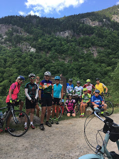
Lancaster to DeBanvile's Store via Vermont Route 102. 9:30 am start

Thursday, August 1, 2019


One of the ThursdayBike Group's favorite places places to ride is the Vermont side of the Connecticut River. Vermont Route 102 is a quiet rural road that is very scenic, no traffic, plenty of Holstein cows along the way. ...very Vermont.The weather looks good for us, sunny and no chance of rain, not too hot  Let's take advantage of this great forecast and head to Vermont!This ride follows VT Route 102, starting from Lancaster, heading north to DeBanville's General Store. This store had been closed for a few years, but it reopened 2 years ago. We can get food and ice cream there for lunch. 

Ride Starts: 9:30, ready to ride, from the parking lot of Shaw's Supermarket in Lancaster, on the right side of Route 3 North, just north of the town center. 

Carpool if you like: Meet in the Attitash parking lot, far end away from the lifts, 8:10 am. Otherwise see you in Lancaster.

Terrain: Lots of flat and some very gradual ups and downs, a few short rolling hills requiring some work; no Asparagus Hill, no notches. Generally a slight uphill on the way out, downhill with a tail wind, of course, on the way back.

How far: 49 miles. See map below. (If you just have to get that 50 mile ride in for your record books - just continue up Route 102 from DeBanville's until your odometer says 25.00 then turn back!!)

Shorter Option? Drive up a bit further up Route 3 north and cross the CT River via the bridge into Guildhall, VT and start from there. Park alongside the Town Green (bear right after you cross the bridge, then make a left alongside the green). This will take 18 miles off and give you a pleasant 31 mile ride. 

Directions: It is a one hour drive to the Shaws Supermarket from the traffic light in Glen. From there it is an equivalent driving time to go up PInkham Notch to Route 2 OR to go Route 302 to Twin Mountain and Route 3.From Glen, using Route 302, head out past Attitash to Bretton Woods and continue to the Twin Mountain  4-corners stoplight. Take a right onto Route 3 north. Follow Route 3 though Whitefield, then continue on Route 3 into Lancaster. Shaw's Supermarket is on the right, approximately 0.5 mile north of the center of Lancaster on Route 3. It is across the street from Dunkin Donuts. Park at the part of the lot closest to the road, furthest from the store entrance. Bathroom in Shaws or at Dunkin's.

Map:  https://ridewithgps.com/routes/13189233

Photos from last week's ride to the top of Evans Notch from Shelburne:


Wednesday, July 24, 2019

Evans Notch from Shelburne. 10:00 am

Thursday, July 25, 2019

This is a good ride for a nice sunny day!

The ride starts at the park in Shelburne, NH in the tChester Hayes Memorial Park, goes over RR tracks and the Androscoggin River to North Road, takes a right turn at the triangle and then out about 5 miles to the iron bridge, crosses the river again and goes to Route 2. We turn right and ride a short distance on a wide shoulder on Route 2, then take the left onto the road up Evans Notch (Rt 113). 

Some will ride up to a small bridge for a nice, easy, gradual route upriver. After the small bridge, the steeper climb to the top begins. Some will climb to the top. Either way is a spectacular ride, and you can regroup down the river at the suspension bridge for a snack or lunch on the rocks, riverside. Return to the cars by reversing the route. 

Mileage: About 32 if you do the whole ride to the top of Evans Notch, about 28 if you go to the bridge just before the climb goes from gradual to steep. 

Shorter option?  Start at the iron bridge for a really nice 18 mile ride. 

Time:  Ready to ride at 10:00 am in Shelburne Village. 
If you want to start at the iron bridge, look for riders coming across it at about 10:30. 

Meeting place and parking: Start from Shelburne Village, in the Chester Hayes Memorial Park, just off Meadow Road (a left turn off of Route 2 about 5 miles east from the route 16/2 junction in Gorham). After turning left into Meadow from Route 2 take a quick right onto Village Road. Take a left into the park and park on the left off the dirt pathway on the grass.  Meadow Road joins North Road at that grassy triangle intersection close to the Philbrook Inn. 

If you want to carpool, meet in Jackson, in the parking lot across the street from the J-Town Deli at 9:00 am.


Here is a map:   https://ridewithgps.com/routes/28223686


Mark Your Calendars!  The Town of Shelburne is celebrating its 250th Anniversary with a full weekend of activities. Included will be live music, dancing in the street, parade, pot lucks, tag sales, historical presentations, house tours, etc., and also guided hikes and bike rides. ThursdayBike and the Spin on Sundays groups will be hosts for the bike rides, which are on Sunday, August 11th. One ride will be Shelburne to Bethel (9:30 am), another, shorter ride, will be Shelburne to the suspension bridge over the Wild River (9:30 am). There will also be an even shorter family-friendly ride (12:00 noon).

For more info:
https://www.townofshelburnenh.com


Tuesday, July 16, 2019

Haleytown Road and the roads of Brownfield. 9:00 am

Thursday, July 18, 2019

The weather forecast looks good for Thursday!

This is a good ride for a nice day. It covers almost all of the pleasant biking roads in Brownfield, Maine. Starting out of the Maine Visitor's Center, the ride goes south on Haleytown Road, then turns left on Hampshire and goes into the village of Brownfield, bearing left onto Main Street, Route 160. Cross Route 5, staying on Route 160,  and cross the Saco River. Bear left to go up Lord's Hill Road, enjoy some views, enjoy the downhill, then right onto Rocky Knoll where you will do a few short but energetic hills. Return by Route 160 and then Pig Street for some nice flat riding.  Heading back on 160 and then Hampshire, bear left on good pavement to Sam Brown's Hill for more good views. The bridge on the downhill side of Sam Browns Hill may be still under construction, if, so turn back from the summit and return to Haleytown via a nice downhill.

Start at the Maine Visitor's Center on Route 302, just over the border in Fryeburg, Maine.

Ready to ride at 9:00 am

Distance 30 miles. Many shorter options are possible!

Add 8 more miles by riding the bike path from the Visitor's Center out and back.

Map: https://ridewithgps.com/routes/30577803

Wednesday, July 10, 2019

The Basin. 9:00 am

Thursday, July 11, 2019

The weather forecast looks good. I delayed in posting because I wanted to confirm that the thunderstorms would be arriving late in the afternoon and would not be a bother to us.

Lets do The Basin ride, it should be a good morning ride, not too hot. We can return before the temperature goes up to much.

Let's meet in North Fryeburg at the corner of South Chatham Road and Route 113, alongside the park next to the Saco Valley Fire Station. As you already know, please do not block the fire station parking area. No bathroom facilities here, use the porta-potty at the little white church at the corner of Fish Street.

Start, Ready to Ride, at 9:00 am

We can head to Fish Street first and do MacNeil, then out on Union Hill and Meadow to the Stow Store. Bring a lunch and/or snacks. You can pick up food at the Stow Store. We can picnic and refill water bottles at the Basin Campground. 

Heading back will be a good ride, a few uphills, but mostly downhill, hope for a tailwind.

Total mileage: 28,   This ride allows for many options to shorten or lengthen the ride and choice of route to get from place to place. 


Here is a map:  https://ridewithgps.com/routes/30519118


Monday, July 1, 2019

Bartlett 4th of July Parade: Muster at Attitash, 9:40 am

Thursday, July 4th, 2019

ThursdayBike is on the 4th of July this year. With so much traffic in the valley, there is no Big Ride, just this traditional Small Marching/Coasting in the parade with lots of laughs.

Bring your kids and grandkids! We will have 3 generations of cyclists marching with the bike club this year! Therefore we are entering the judging contest. We will need to be judged before 10:15am.

If you cannot be there that early, just bike over there in time to line up for the parade no later than 10:50. Parade starts at 11:00. The line-up occurs in the baseball field on Route 302, west of the post office, west of the rr tracks.

Information on the BARTLETT 4th of July Parade, marching with the Bicycling Club Banner:  Same routine as in the past:

If you have never been to the Bartlett 4th of July Parade, it is worth a trip. What a hoot!! It drips with small town charm. Lots of fire trucks (bring ear plugs...), old cars and "floats" pulled by lawn mowers. Politicians and Miss Mt. Washington Valleys in tiaras perched in convertibles. It starts at 11:00. This is a big deal --- they actually close Route 302 for this event, causing a huge 4th of July Traffic Jam of confused, surprised and cranky tourists (and locals). But the show must go on! 

Best way to see this spectacle is by bike. Meet at the Attitash parking lot at 9:40 am, ready to ride, at the far west end of the lot, away from the lifts, in the shade. We can ride over to Bartlett Village before Route 302 turns into a linear parking lot of annoyed drivers. After the parade, get a bowl full of strawberry shortcake made by the church ladies and gents, hot dogs prepared by the cub scouts or ice cream from Trail's End. After the festivities, you could do some miles on River Road, if you like.

By then the traffic should clear for returning to our cars at Attitash. 

Meet at 9:40 am, ready to ride at Attitash. I have some red white and blue bling for decoration if you need it.  You cannot dress up silly enough. Try for the red, white and blue for your bike and/or for you. We will need to bike over there to be judged, cut off for the judging is 10:15 am.

Here are a few prime examples for you to attempt to emulate: