Tuesday, August 11, 2020

The Basin 9:00 am

 Thursday, August 13, 2020

How about The Basin Ride, It should be a good ride, not TOO hot on Thursday. There is a lot of traffic in the valley in mid to late August....but this ride is typically quiet even in the busy season. 

Meet in North Fryeburg at the corner of South Chatham Road and Route 113, alongside the park next to the Saco Valley Fire Station. As you already know, please do not block the fire station parking area. If it looks too crowded, another place to park is in the parking area along the fence at the little white church on the corner of Fish St. I have not seen a porta potty out there this season, so plan accordingly...


Start, Ready to Ride, at 9:00 am

Head to Fish Street first to enjoy good pavement and do MacNeil, then out on Union Hill and Meadow to the Stow Store. Bring a lunch and/or snacks. You can pick up food at the Stow Store. You can picnic and refill water bottles at the Basin Campground. 

Heading back will be a good ride, a few uphills, but mostly downhill, hope for a tailwind.

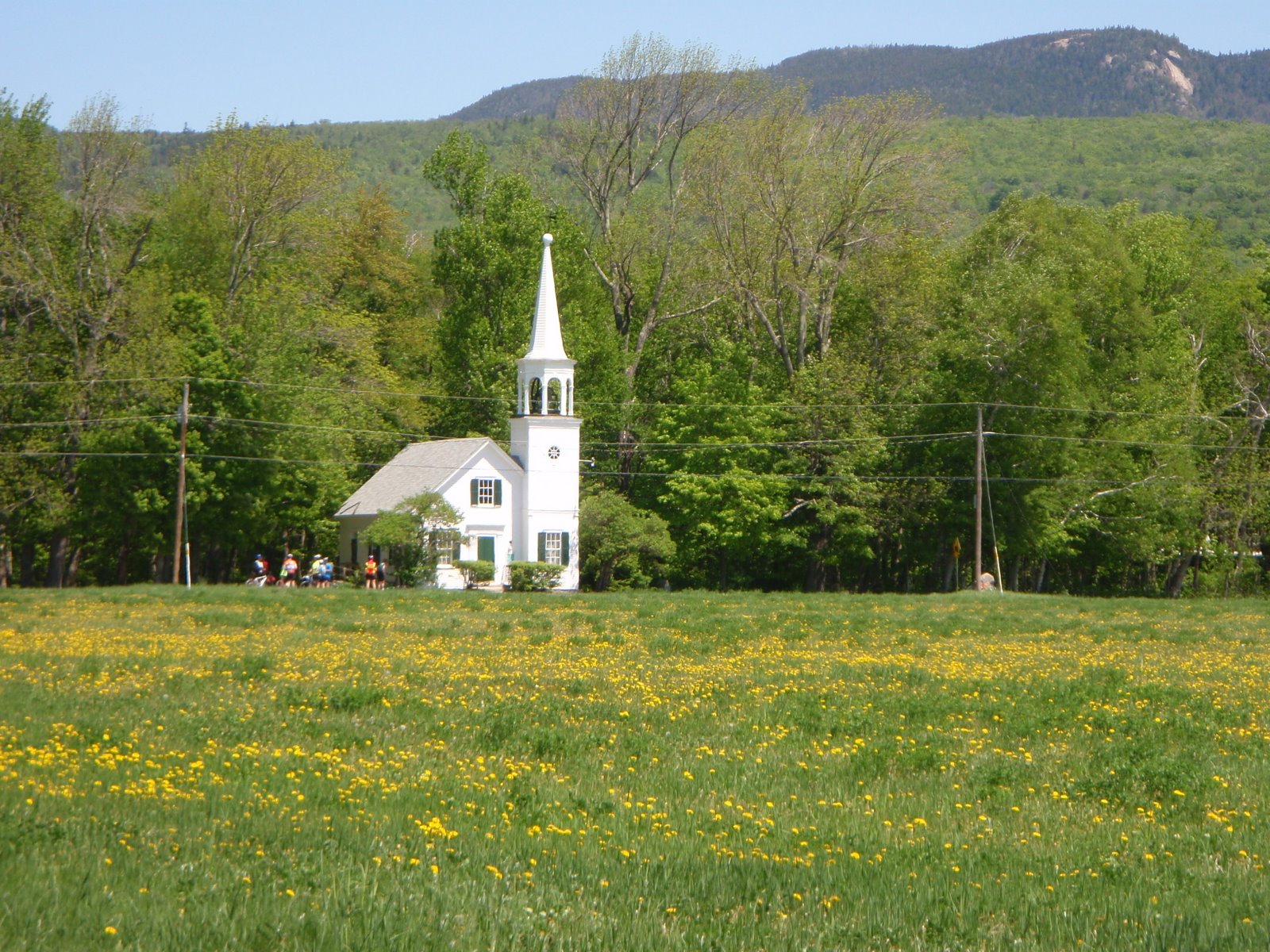
It always was Red Hot Dog Thursday at the little white church, but I don't know if this is happening this year due to the Covid-19 issues.

Total mileage: 28,   This ride allows for many options to shorten or lengthen the ride and choice of route to get from place to place. 
If you want a longer ride, start at the Maine Visitors Center to add a total of 18 more miles (9 miles each way), for a total of 46 relatively easy miles. If you start riding from the visitors center at 8:00 or 8:15 you should easily meet the group at the Fire Station or at the little white church as we turn onto Fish street to head to MacNeil. 


Here is a map:  https://ridewithgps.com/routes/30519118


Tuesday, August 4, 2020

Lost Nation Loop: 50 or 27 miles 9:00 am

Thursday, August 6, 2020

Thursday will be beautiful weather, typical after a tropical storm system passes through.

Farms, fields, horses, cows, mountain views, 2 covered bridges, rivers, streams, villages, little white churches, closed papermills, Vermont and New Hampshire scenery. This ride has everything the region can offer! 

The full loop is 50 miles, but there is an excellent 27 mile option that avoids most of the climbs.  This is a nice 50, the climbing is in the first part of the ride.

I will host the 27 mile version.

EVERYONE should meet in Whitefield at 9:00 am, whether you do the 50 or 27 miler. The 27's will then drive 10 minutes to Lancaster and start from there. 

The 50 Miler: The Lost Nation Loop starts in Whitefield at the town green with the gazebo in the center. Ride east towards Jefferson on Route 116, then North Road through Grange and Lost Nation (tiny white church) to Groveton. We then ride about 2.5 miles down Route 3 (wide shoulder) to Northumberland and cross the CT River into Guildhall, VT. We ride the VT side of the CT River on Route 102 then cross the long Mt. Orne Covered Bridge just south of Lancaster. We ride almost to Dalton along the NH side of the CT River and then take route 142 back to Whitefield. This riverside cruising downstream from Groveton is superb biking!

Shorter Option:  27 miles  A shorter, easier loop with less elevation gain can be done out of Lancaster, parking at the Shaw's Supermarket. If you want to do this version, meet at the Whitefield Gazebo with everyone else at 9:00, get the plan, then drive up to Lancaster. We will meet the 50 mile riders at the big dairy farm at the corner of Grange Road. You will have cut out the longest and steepest climbs.

Bring a lunch to eat at the white covered bridge in Groveton. Bring plenty of water. There is a convenience store/gas station near the covered bridge that is hopefully still open for water refills and snacks.

Meet time: 9:00 am.  ALL riders meet in Whitefield at the gazebo.

Carpooling: If you want to carpool, meet at the Attitash parking lot at 7:50 am, otherwise, see you in Whitefield.

Directions to Whitefield: Route 302 through Crawford Notch to the light at Twin Mountain four corners. Take a right onto Route 3 and follow Route 3 to the center of Whitefield, a tiny town green with a gazebo. 50 minute drive from beautiful downtown Glen.

Parking in Whitefield: There is parking around the town green in the center of Whitefield (intersection of Routes 3, 116, 142). There is a large parking lot behind the gas station that works well. Avoid the 2-hour limit parking spaces.


History: Lost Nation seems to always be associated with The Republic of Indian Stream, (perhaps because of the book written about this interesting region of NH? Lost Nation, by Jeffrey Lent). The place called Lost Nation, where we will ride (don't blink or you may miss it...), is not geographically contained within the former Republic of Indian Stream, which is closer to Pittsburg. On the Pittsburg/Colebrook bike ride we travel over the rivers that bounded the Republic of Indian Stream, which was the Lost Nation, but this is well north of where the village of "Lost Nation" is on a map. I have not been able to remedy this inconsistency!
For a history of The Republic of Indian Steam here is a short review: https://en.wikipedia.org/wiki/Republic_of_Indian_Stream


Map, 50 mile ride:
From Whitefield: https://ridewithgps.com/routes/28020766

Elevation profile:


Map: Shorter version, 27 miles, from Lancaster:  https://ridewithgps.com/routes/13191276

Elevation profile:


Wednesday, July 29, 2020

Jefferson and Randolph, Valley Views 9:00 am

Thursday, July 30, 2020


This is a summer version of The Lupine Ride, with great views of the Presidentials, Wambek and Cherry Mountain. It is also a section of the Cross New Hampshire Adventure Trail that is likely the most scenic, if you have never done this ride, you will be happily surprised at how beautiful it is!

Valley Road has excellent views. It also had a dirt section for the road for about 1.8 miles. It has been in good shape this season. Bring a gravel grinder or hybrid or mountain bike if you want to fly right through this section with a smile. Having a bike with wider tires also allows you to return to your car using the Presidential Rail Trail, a gem! I would encourage you to bring the wider tires, lead the skinny ones at home.

Start time: 9:00 am ready to ride 


Bring lunch or snacks. 


Meet at the parking lot on the west (Randolph) end of Pinkham B Road at the rail trail crossing near the public works building. 9:00 am start.


Carpool: Meet at the Jackson Ski Touring/Wentworth Golf Club parking area across the street from the J-Town Deli at 8:10 am.

Ride length: 28 miles. Add 4 more if we decide to head into Pondicherry to the viewing platform. It is 34 miles if we decide to add the Jefferson loop. 

Route description: Cross Route 2 over to Durand Road. Ride it all the way up to the end of the dead end and walk the path up to Route 2. Ride about 1.5 miles and take a left onto Valley Road. Ride out Valley to Route 115. We can go into Pondicherry or go up to Jefferson, we can decide there.  Head back by Valley Road then choose Durand Road or the Rail Trail for the smiling downhill back to Pinkham B. 

Directions to the start: The start is at the Randolph end of the Pinkham B Road. There is parking right next to where the Presidential Rail Trail crosses Pinkham B. 
Drive route 16 to Gorham, follow it left at the intersection and then take a left on Route 2 at the traffic light. Go up the big hill and down the other side. Just as the hill flattens, Pinkham B Road will be on your left. Take the left and drive about 0.5 mile to the parking area near the rail trail on the right.

For a map:
http://www.mapmyride.com/routes/view/18419892

Wednesday, July 22, 2020

Bear Notch Road and Experimental Forest 9:00 am

Thursday, July 23rd

It appears that the weather will be OK for a bike ride in the morning. Some rain and thunderstorms are due in the afternoon. So let's get out for a ride, close to home with escape options if the weather comes in earlier than predicted.

It the weather comes in MUCH earlier than predicted, I might have to cancel the ride, so check in with this blog site if you are seeing rain closing in on our area in the morning.

Meet at the Thorne Pond parking lot (across from the Attitash Bear Peak Parking lot) on Route 302. We will bike into Bartlett Village for a warm up, then take our time heading up Bear Notch Road on NEW PAVEMENT. Going at your own pace, nice and steady, will spread us out at the appropriate Bicycling Distancing.

Once to the top you have two options for the downhill.

1.  Take the road back down and enjoy the new pavement.

2.  If you bring your gravel , hybrid or All Road bike, we will descend on the dirt roads of the Experimental Forest. Perhaps you have xc skied these roads on a ThursdaySki last year .You will recognize some parts of the road systems if you xc ski at the Bear Notch Ski Touring Center.

Let's meet at 9:00 am, ready to ride. This ride is relatively short, likely no more than 18 miles, but it is a good workout!


Monday, July 13, 2020

Lamoille Valley Rail Trail 9:30 am

Thursday, July 16, 2020

The eastern end of the Lamoille Valley Rail Trail runs about 17 miles from St. Johnsbury to Joe's Pond in Danville. It is part of a project that is patching together pieces of the rail line to eventually establish the longest continuous rail trail in New England, stretching about 100 miles across Vermont from St. Johnsbury to St. Albans.

The surface is hard packed smooth stone dust. There are tunnels and bridges, lots of forest, good views of the Vermont hillsides and some lakeside biking. Dan's Pond is a good place for a swim. When we have done the trail in the past there were bikers, pedestrians, dog walkers, and horses out enjoying the trail. The weather forecast looks perfect for this out-of-the-valley-experience. Escape from the local traffic!!

The surface is fine for most bikes. Skinny tired road bikes have been used on this trail,  only a few soft spots located at a few road crossings need some care. If you have a hybrid or bike with wider tires, a mountain bike, all will be fine on this trail.  The trail climbs gradually all the way to Joe's Pond. The downhill trip back is a hoot!

Check out the website:  www.lvrt.org

Round trip we will have a 34 mile car-free adventure!

Time:  Ready to ride at the Lamoille Valley Rail Trailhead at 9:30 am. It is about 1 hour 15 minute drive. No porta-potty at the trailhead, so stop at the Welcome to Vermont Visitor's Center on the right side of Route 93 soon after you cross the CT River.

Carpool? If you like, meet at Attitash parking lot, far end away from the lifts, at 8:00 am to carpool, otherwise, meet at the trailhead in St Johnsbury.

Bring snacks and/or lunch or stop at the General Store. Maybe the food truck at Joe's Pond will be there. We can eat at picnic tables on the beach at Joe's Pond. Bring swim clothes if you like.

Directions:

Take Route 302 over Crawford Notch towards Bethlehem and get onto Route 93 north to Vermont. At the Route 91 interchange, go north on 91 for a very short distance, hardly off the entrance ramp. Take this first exit, Exit 20, Route 5, then take a right at the end of the ramp and go a short distance, noticing the sign for the bike path on the right. It is called Railroad Street or Main Street depending on map. Take the right and then immediate right again down a short steep slope into the trailhead parking lot. It is a very quick succession of right, right, right, right. The map app says it is a 1 hour 15 minutes drive.

A fun group on the Lamoille Valley Rail Trail, back when we could be socially close!!

Tuesday, July 7, 2020

North Road to Wild River, a dirt and pavement ride with an all-pavement option. 9:00 am

Tuesday, July 7, 2020

I am still trying to establish a way to comfortably run Tuesday and Thursday rides in this new virus-threatened world.

For now, I will dive in and start by setting up a ThursdayBike this week. To make the ride amenable to distancing and smaller groups, or "pods", I will set it up as mainly a Dirt and Pavement Ride, with an option for an all-road ride. This way the group can meet and ride together (physically distanced of course) for awhile then split up.

Let's see how this works. (?). I will use this first attempt at a ride and will talk with riders about their interest in attending Tuesday's and Thursday's rides.  I will see what the attendance is, and I will observe how physical distancing works for group rides.

You have two options: I will lead the Dirt and Pavement Ride, North Road to Evans Notch Road then to the DIRT, scenic Wild River Road. It is an out and back ride. Meet at 9:00 am in Shelburne.

Tom Sweeney will lead the All-Pavement Ride, North Road to Evans Notch Road, paved and scenic to the top of Evans Notch, also an out and back ride. Meet at 9:00 am in Shelburne.


Here are the details:

North Road from Shelburne to the Wild River Road

Wild River Road is a really nice dirt road that goes alongside the Wild River in Evans Notch. It leads to a campground. It is a scenic gradual uphill at river grade, easy. We did this ride early in June last year and enjoyed lunch on the rocks in the river. Looks like the weather may allow us to dine in the sunshine on the rocks again!

The ride starts in Shelburne Village, NH, at the Chester Hayes Memorial Park. We head to North Road and go to the iron bridge over the Androscoggin River. Ride over the bridge and stop for a nice river view. Continue to Route 2, take a right and after a short distance, turn left onto Route 113 (new pavement last year!), the road to Evans Notch. This is a beautiful ride along the Wild River. After 3.3 miles, you will take a right onto a dirt road, Wild River Road, that leads 5 miles to a backcountry campground. Ride this out and back.  Lunch break on the rocks in the sunshine.

Distance: About 30 miles. 20 miles on pavement and 10 miles on a good dirt road.

Time: Meet at the park in Shelburne ready to ride at 9:00 am.

Bike: A mountain bike will be OK, but a Hybrid, All-Road or Gravel Grinder is better due to the 20 miles on pavement. A road bike with wider tires can work also.

For skinny tires, do the:

ALL-PAVEMENT RIDE:  Bike up Evans Notch rather than up Wild River Road. Tom Sweeney will lead this ride option. Meet at the park in Shelburne ready to ride at 9:00 am.

Meeting place and parking: Start from Shelburne Village, just off Meadow Road (a left turn off of Route 2 about 5 miles east from the Route 16/2 junction in Gorham). After turning left into Meadow from Route 2, take a quick right onto Village Road. Take a left into the Chester Hayes Memorial Park and park on the left, off the dirt pathway on the grass.  There is a Porta Potty in the field!

If you want to carpool, meet in Jackson, in the parking lot across the street from the J-Town Deli at 8:10 am. Otherwise, see you in Shelburne at 9:00 am!


Map:  https://ridewithgps.com/routes/28390552

Wednesday, July 1, 2020

ThursdayBike will start NEXT week

Wednesday, July 1st

Greeting ThursdayBikers. I miss all of you and miss the Thursday rides!

During the official shutdown for the coronavirus issues, club rides could not be hosted. Now the shutdown is over, but we still must be diligent to physically distance, wear masks and be smart about how we "Open Back Up". The virus is out there and causing a huge spike in activity is parts of the USA. With the July 4th weekend already bringing in the crowds, I decide to wait until next week to start the rides.

I will start ThursdayBike rides NEXT week, July 8th.