No ride planned for Thanksgiving morning.
The cold morning temperature and the residual salt on the pavement has convinced me that staying inside, watching the parade on TV and/or taking a walk might be a better option between the cooking duties.
I will continue to try to post bike rides for Thursdays, weather permitting, likely on bike paths or dirt roads if there is appropriate weather and no snow or ice. As an alternative, a good long walk/hike could be a good way to get out of the house while we anxiously look out the window for snow accumulation. Check this blog if your are curious about an expedition on Thursdays.
As the snow falls, I will change ThursdayBike into ThursdaySki, so keep checking the blog if you want an xc-ski adventure on Thursdays throughout the winter and spring.
The bike club calendar may not have the link to this blog during the winter season. If not there, go directly to the information on the blog:
www.thursdaybike.blogspot.com
Have a fun Thanksgiving! I am thankful for such great group of biking friends!
Wednesday, November 22, 2017

Wednesday, November 15, 2017
RIde Cancelled this week
Thursday, November 16th, 2017
The forecast just does not look good for a bike ride this Thursday.
IF the weather cooperates next week, I will set up a bike ride on Thanksgiving morning, a short one in the North Conway area. It would be nice to get in a ride before the turkey dinner celebration with friends and family!
I will continue to try to post bike rides for Thursdays, weather permitting. As the snow falls, I will change ThursdayBike into ThursdaySki, so keep checking the blog if you want an xc-ski adventure on Thursdays throughout the winter and spring. Until the snow accumulates enough for xc skiing, there might be a hike posted instead.
The bike club calendar may not have the link to this blog on their calendar during the winter season. If not there, go directly to the information on the blog:
www.thursdaybike.blogspot.com
Have a fun Thanksgiving! I am thankful for such great group of biking friends!
The forecast just does not look good for a bike ride this Thursday.
IF the weather cooperates next week, I will set up a bike ride on Thanksgiving morning, a short one in the North Conway area. It would be nice to get in a ride before the turkey dinner celebration with friends and family!
I will continue to try to post bike rides for Thursdays, weather permitting. As the snow falls, I will change ThursdayBike into ThursdaySki, so keep checking the blog if you want an xc-ski adventure on Thursdays throughout the winter and spring. Until the snow accumulates enough for xc skiing, there might be a hike posted instead.
The bike club calendar may not have the link to this blog on their calendar during the winter season. If not there, go directly to the information on the blog:
www.thursdaybike.blogspot.com
Have a fun Thanksgiving! I am thankful for such great group of biking friends!
Wednesday, November 8, 2017
North Fryeburg Late Fall Fields 11:30 start
November 9, 2017
A cool day but should be good for a casual ride over in North Fryeburg. The fields are likely all harvested and prepared for the winter. We could do the usual routine that includes Cornshop, Fish , Harbor then head up to the Stow Store if desired.
If you bring a "Dirt and Pavement"-capable bike, we can explore the dirt road that parallels the Old Saco River. I am not sure if the recent storm took that road away, so let's check it out and see what condition it is in.
Meet at the park next to the Saco Valley Fire Station in North Fryeburg, ready to ride at 11:30. Starting time is later than usual to let the temperature rise a bit. Bring lunch or snacks.
A cool day but should be good for a casual ride over in North Fryeburg. The fields are likely all harvested and prepared for the winter. We could do the usual routine that includes Cornshop, Fish , Harbor then head up to the Stow Store if desired.
If you bring a "Dirt and Pavement"-capable bike, we can explore the dirt road that parallels the Old Saco River. I am not sure if the recent storm took that road away, so let's check it out and see what condition it is in.
Meet at the park next to the Saco Valley Fire Station in North Fryeburg, ready to ride at 11:30. Starting time is later than usual to let the temperature rise a bit. Bring lunch or snacks.
Wednesday, November 1, 2017
Rained out, again
Thursday, November 2, 2017
I am just not impressed by any of the forecasts. I think it will be either drizzle or damp with wet roads, so I guess I must cancel for this week.
Try again next week!!
I am just not impressed by any of the forecasts. I think it will be either drizzle or damp with wet roads, so I guess I must cancel for this week.
Try again next week!!
Tuesday, October 24, 2017
Rained out this week.
Thursday, October 26th, 2017
A rainy Thursday, so no ride. Great to finally get the rain - we needed it!
Hope to have better riding weather next Thursday! See you then!!
A rainy Thursday, so no ride. Great to finally get the rain - we needed it!
Hope to have better riding weather next Thursday! See you then!!
Tuesday, October 17, 2017
Lakes, Foests and Pine Barrens Ride: Madison, Freedom and Tamworth 10:00 am
Thursday, October 19th, 2017
The Lakes and Pine Barrens Ride will start at the Madison Selectmen's Town Offices Parking lot (Route 113, 1923 Village Rd, on the right side of the road just before the library when driving west; the building is up a driveway from the road). There is a large lot in the back of the building. The route travels east and over the hill to Route 153 then south to Bennet Street. Taking a right on Bennet we go east alongside the Freedom Town Forest and Ossipee Pine Barrens. The route goes by Camp Calumet at the northern tip of Ossipee Lake, crosses Route 16 and goes on Route 25 in West Ossipee for about a mile, then takes Old Route 25 and 113 into Tamworth Village.
We can eat lunch at the picnic tables behind The Other Store because it should be warm enough for a picnic!. You can buy food and/or ice cream there. After the lunch stop in Tamworth, return via Depot Road, the northern end of Silver Lake, East Madison Road to our cars.
The distance is 33 miles.
Meet at the Town Offices parking lot at 10:00 am, ready to ride. The afternoon temperatures will be in the mid 60s to 70!
For those from the Glen/Bartlett/Jackson area, if you want to carpool, meet at the back of Grant's parking lot at 9:00 am.
Here is a map:
http://www.mapmyride.com/routes/view/1826427440
Info on The Pine Barrens:
https://www.nature.org/ourinitiatives/regions/northamerica/unitedstates/newhampshire/places-preserves/ossipee-pine-barrens.xml
http://ossipeelake.org/lake/special-places/ossipee-pine-barrens/
Tuesday, October 10, 2017
The Lost Nation Ride, 10:00 am start from Whitefield Gazebo
Thursday, October 12th, 2017
Thursday looks perfect for a ride, low sixties, sunshine, foliage and a tailwind, for sure. All the weather forecasts were in sync with this, for a change!! Easy planning! So it is fitting that we do a good long ride that should be beautiful in the fall colors!! This is one of my many favorites for spectacular scenery!
The full loop is 50 miles, but there is a really nice 27 mile option that avoids many of the climbs.
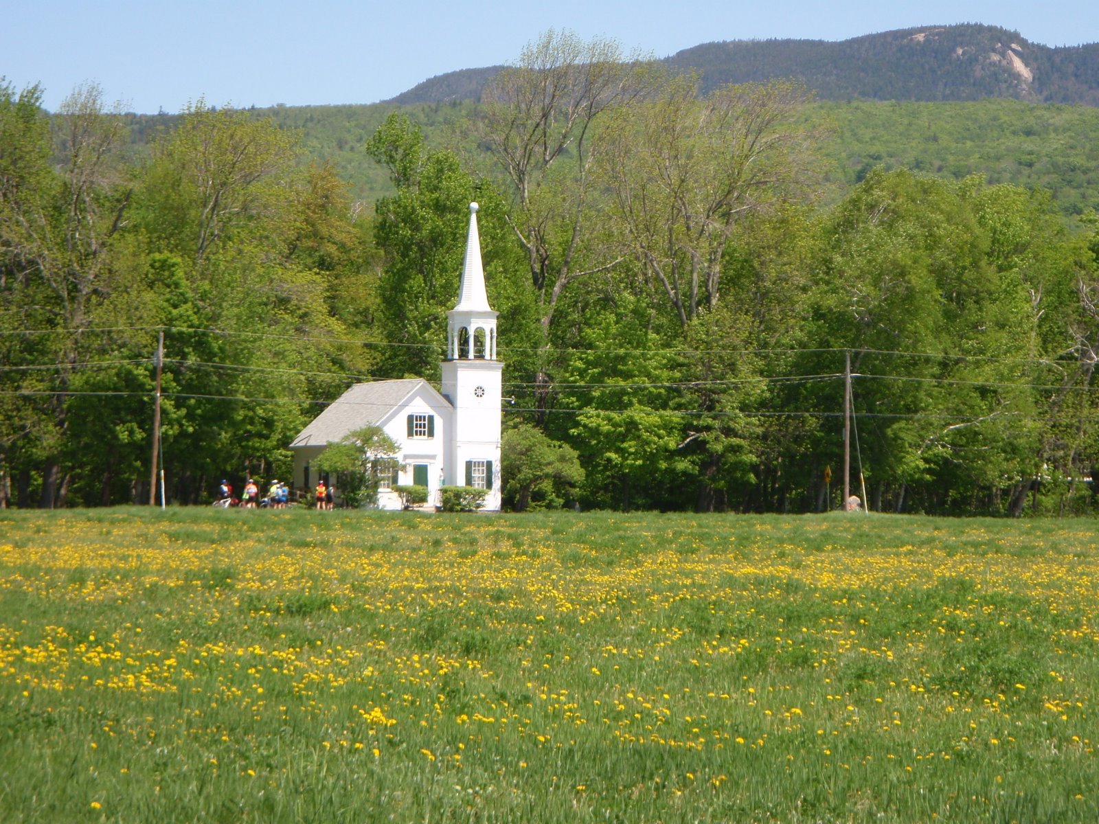
The Lost Nation Loop starts in Whitefield at the town green with the gazebo in the center. We ride east towards Jefferson on Route 116, then North Road through Grange and Lost Nation (tiny white church) to Groveton. We then ride about 2.5 miles down Route 3 (wide shoulder) to Northumberland and cross the CT River into Guildhall, VT. We ride the VT side of the CT River on Route 102 then cross the long Mt. Orne Covered Bridge just south of Lancaster. We ride almost to Dalton along the NH side of the CT River and then take route 142 back to Whitefield. This riverside cruising downstream from Groveton is superb biking!
Bring a lunch to eat at the white covered bridge in Groveton. There is a convenience store/gas station near the covered bridge, but I am never certain if any of these northern NH stores are still open, better to have some food with you!
Bring a lunch to eat at the white covered bridge in Groveton. There is a convenience store/gas station near the covered bridge, but I am never certain if any of these northern NH stores are still open, better to have some food with you!
Start time: 10:00 am, ready to ride
Carpooling: If you want to carpool, meet at the Attitash parking lot at 8:40 am
Directions to Whitefield: Route 302 through Crawford Notch to the light at Twin Mountain four corners. Take a right onto Route 3 and follow Route 3 to the center of Whitefield, a tiny town green with a gazebo. One hour drive from beautiful downtown Glen.
Parking in Whitefield: There is parking around the town green in the center of Whitefield (intersection of Routes 3, 116, 142).
Parking in Whitefield: There is parking around the town green in the center of Whitefield (intersection of Routes 3, 116, 142).
Ride Distance: 50 miles, majority of the climbing happens early in the ride, when we are still fresh.
Shorter Option: 27 miles A shorter, easier loop can be done out of Lancaster, parking at the Shaw's Supermarket. If you want to do this version, meet at the Whitefield Gazebo with everyone else at 10:00, get the plan, then drive up to Lancaster. You will meet the 50 mile riders at the big dairy farm at the corner of Grange Road. You will have cut out the longest and steepest climbs.
History ?: Lost Nation seems to always be associated with The Republic of Indian Stream, (perhaps because of the book written about this interesting region of NH? Lost Nation, by Jeffrey Lent). The place called Lost Nation, where we will ride (don't blink or you may miss it...), is not geographically contained within the former Republic of Indian Stream, which is closer to Pittsburg. On the Pittsburg/Colebrook bike ride we travel over the rivers that bounded the Republic of Indian Stream, which was the Lost Nation, but this is well north of where the village of "Lost Nation" is on a map. I have not been able to remedy this inconsistency!
For a history of The Republic of Indian Steam here is a short review: https://en.wikipedia.org/wiki/Republic_of_Indian_Stream
Note on that Pittsburg/Colebrook/Route 145 amazing bike ride...There is a section of Route 145 that has been closed due to construction, supposedly ready to open by late October. IF we continue with good enough weather to head up there to do this ride on the reopened road, I will certainly set it up!
Map, 50 mile ride:
http://www.mapmyride.com/us/deerfield-nh/lost-nation-loop-route-1539328
Elevation profile:

Map: Shorter version, 26 miles: http://www.mapmyride.com/us/northumberland-nh/lost-nation-loop-from-lancaster-route-110831617
Elevation profile:

For a history of The Republic of Indian Steam here is a short review: https://en.wikipedia.org/wiki/Republic_of_Indian_Stream
Note on that Pittsburg/Colebrook/Route 145 amazing bike ride...There is a section of Route 145 that has been closed due to construction, supposedly ready to open by late October. IF we continue with good enough weather to head up there to do this ride on the reopened road, I will certainly set it up!
Map, 50 mile ride:
http://www.mapmyride.com/us/deerfield-nh/lost-nation-loop-route-1539328
Elevation profile:

Map: Shorter version, 26 miles: http://www.mapmyride.com/us/northumberland-nh/lost-nation-loop-from-lancaster-route-110831617
Elevation profile:

Subscribe to:
Posts (Atom)