Wednesday, June 30, 2021

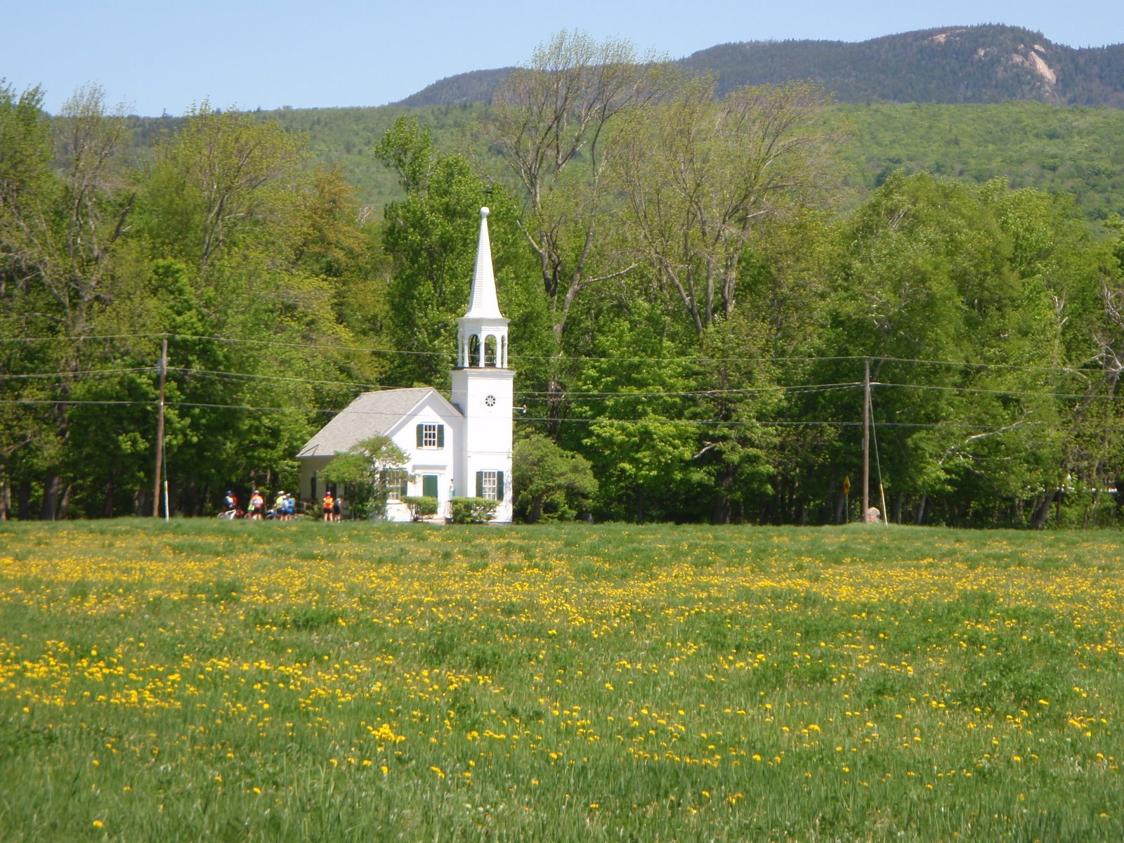
Bike Path, Fryeburg Village and Menotomy Road. 9:00 am. Ride Code B/2/20

Fryeburg Village and Menotomy Road 9:00 am

Thursday, July 1st, 2021

I have been watching the weather, expecting rain for Thursday, but the rain seems to be pushed off until later in the day. The the temperature will be in the high 70's, so a bit of a relief! It is worth setting up a close-to-home short morning ride that should get us out and back before any wet weather comes in.
Meet at the Maine Visitor's Center on Route 302 just over the border in Fryeburg where the Mountain Division Rail Trail starts. We start with a lap on the "Rails With Trails" bike path and Porter Road, then go into Fryeburg Village, head over to the Snow School and Ice House Road. We cross Route 302 onto Menotomy Road, which is a very scenic out-and-back ride. It has short climbs that will keep us exercised.  More miles, if the weather holds, can be achieved on Haleytown Road. 

Distance?  Probably about 20 miles, plus more if we do some of Haleytown Road before any rain would gladly be received.
Ride Code:  B/2/20
Map:  https://ridewithgps.com/routes/13100838


Ready to ride at 9:00 at the Maine Visitor's Center.

Monday, June 21, 2021

Bear Notch Loop 9:00 am B/3.5/38

Thursday, June 24, 2021

This week Laurel will host ThursdayBike!  She has chosen the Bear Notch Loop, clockwise, starting at 9:00 am in the parking lot behind the Eastern Slope Inn, North Conway.  You will go down West Side Road, then up Passaconaway, up the Kanc and up Bear Notch Road. The downhill is a blast, then you return to Eastern Slope by Route 302 and upper West Side Road.

Ready to Ride at 9:00 am!!  Bring food and water.

The loop is about 37 miles, and is rated a B/3.5/38.

Here is the map:  https://ridewithgps.com/routes/13070517

Enjoy the ride! See you next week!


Tuesday, June 15, 2021

Vermont Side of the Connecticut River, Lancaster to DeBanville's General Store 9:30 am. B/3/49

Thursday June 17, 2021


One of the ThursdayBike Group's favorite places is the Vermont side of the Connecticut River. Vermont Route 102 is a quiet rural road that is very scenic, plenty of Holstein cows along the way. ...very Vermont and very Green in the springtime.

This ride follows the southern section of VT102, starting from Lancaster and ending at DeBanville's General Store in Bloomfield, VT. We can get food and ice cream at the lunch stop, but bring some food to have on the bike, just in case.

Weather: Looks good! 

Ride Starts: 9:30, ready to ride, from the parking lot of Shaw's Supermarket in Lancaster, on the right side of Route 3 North, just north of the town center. Drive about an hour to Lancaster from the traffic light in Glen.

Carpool if you like: Meet in the Attitash parking lot, far end away from the lifts, 8:15 am. Otherwise see you in Lancaster.

Terrain: Lots of flat and some very gradual ups and downs, a couple of rolling hills requiring some work. MWV Bike Club Ride Code: B/3/49

How far: 49 miles. See map below. (If you just have to get that 50 mile ride in for your record books - just continue up Route 102 from DeBanville's until your odometer says 25.00 then turn back!!)

Shorter Option?!!! Drive up a bit further up Route 3 north and cross the CT River via the bridge into Guildhall, VT and start from there. Park alongside the Town Green (bear right after you cross the bridge, then make a left alongside the green). This will take 18 miles off and give you a great 31 mile ride. 


Directions: Take Route 302 to the Twin Mountain 4-corners stoplight. Take a right onto Route 3 north. Follow Route 3 though Whitefield, then continue on Route 3 into Lancaster. Shaw's Supermarket is on the right, approximately 0.5 mile north of the center of Lancaster on Route 3. It is across the street from Dunkin Donuts. Park at the part of the lot closest to the road, furthest from the store entrance.

Bring: Snacks and water. 


Map:

https://ridewithgps.com/routes/13189233

Wednesday, June 2, 2021

Attitash to the Willey House. 9:00 am Ride Code: B/2/28

Thursday, June 3, 2021

7:50 am WEATHER UPDATE: Looks like it will be OK to ride, maybe not the beautiful day like yesterday, BUT no rain until later this afternoon. 

This is a relatively short ride, 28 miles (Ride Code B/2/28), good for getting a workout in before any rain might happen. Let's start at 9:00 am since it will be warm and there is less chance of wet weather earlier in the day. If you want to shorten it, you can start in Bartlett Village or at the 4th Iron or Sawyer River Road parking lots.

Meet at the Attitash parking lot, the far western end, ready to ride at 9:00 am. We will ride up to the Willey House, then enjoy the ride back down. There has not been much traffic lately, so this is a good time to do this ride, before the tourist traffic builds up.

Here is a map:

https://ridewithgps.com/routes/27335545


Wednesday, May 26, 2021

Evans Notch from Shelburne. 10:00 am Ride Code: B/3/32 or B/2/28

Thursday, May 27, 2021

I will be away, so Bob Holdsworth has offered to host the Thursday ride this week. It will be Shelburne to Evans Notch, a favorite ride with lunch on the riverbank.

The ride starts at the Chester Hayes Memorial Park in Shelburne, NH, goes over RR tracks and the Androscoggin River to North Road, takes a right turn at the triangle and then out about 5 miles to the iron bridge in Gilead, crosses the river again and goes to Route 2. We turn right and ride a short distance on a wide shoulder on Route 2, then take the left onto the road up Evans Notch (Rt 113). 

Some will ride up to the small bridge for a nice, easy, gradual, beautiful route upriver. After the small bridge, the steeper climb to the top begins. Some will climb to the top. Either way is a spectacular ride, and you can regroup down the river at the suspension bridge for a snack or lunch on the rocks, riverside. Return to the parking area in Shelburne by reversing the route. 

Mileage: About 32 if you do the whole ride to the top of Evans Notch, Ride Code B/3/32.  It is about 28 miles if you go to the bridge just before the climb goes from gradual to steep, this version is easier, so Ride Code B/2/28.

Shorter option?  Start at the iron bridge in Gilead for a really nice 18 mile ride. There is a large parking lot onto south side of the bridge. Ride Code B/2/18.

Time:  Ready to ride at 10:00 am in Shelburne Village. 

If you want to start at the iron bridge, look for riders coming across it at about 10:20-10:30. 

Meeting place and parking: Start from Shelburne Village, in the Chester Hayes Memorial Park, just off Meadow Road (a left turn off of Route 2 about 5 miles east from the route 16/2 junction in Gorham). After turning left into Meadow from Route 2 take a quick right onto Village Road. Take a quick left into the park and park on the left off of the dirt pathway on the grass.  Porta potty in the park, WooHoo!

If you want to carpool, meet in Jackson, in the parking lot across the street from the J-Town Deli at 9:10 am, otherwise meet everyone in Shelburne.


Here is a map:   https://ridewithgps.com/routes/28223686

Tuesday, May 18, 2021

North Road from Shelburne to Bethel 10:00 am. Rating: B/2/35

Thursday, May 20, 2021

Looks like good weather for Thursday! 

Let's check the springtime green fields and flowering trees on North Road. If you have never done North Road....it is an absolute bikers paradise, a real gem. -- It runs parallel to Route 2 on the north side of the Androscoggin River - the traffic stays on Route 2, good place for it. 

Let's start in Shelburne Village. It cuts out some miles, cuts out a few sharp climbs at the very end, and adds a nice ride on a quiet road with nice views. Good for the early season. The Shelburne Town Officials are glad to have us there, and the porta potty is installed in the field, ready for use.

Start: Ready to ride at 10:00 am. 

Total Mileage: about 35. This is rated a B/2/35

Park in Shelburne Village: To get to the parking area take Route 16 north to Gorham, take a right on Route 2 heading east, go about 5.6 miles. Take a left into Shelburne Village, (might be signed as Meadow Road) then very shortly afterward take a right into the tiny village. Park in the playing field/ballpark (Chester Hayes Memorial Park) on the left side of the road (via a dirt driveway).

Bring lunch to enjoy at the riverside park in Bethel. There is a convenience store just before the park, if needed.

Carpool?  If you want to carpool, meet in Jackson at the parking lot across the street from the J-Town deli at 9:10 am, otherwise, see you in Shelburne.

Map:   https://ridewithgps.com/routes/30119451

Wednesday, May 12, 2021

Emerald Green Fields of North Fryeburg, Rated A/2/21. 10:00 am

 Thursday, May 13, 2021

It should be a great day for a scenic, easy ride in the North Fryeburg-Chatham-Stow area!

Start 10:00 am, ready to ride, next to the North Fryeburg Fire Station at the corner of Route 113 and South Chatham Road.  They have expanded the parking lot into the grassy park, I presume to help keep cars off of the roadside. 

Last time I was over there, the fields were either emerald green or ready for planting the corn or potatoes. 

The route starts south on Route 113 to Cornshop, then Route 5, Fish, McNeil, Harbor, Union Hill, Meadow, the Stow Store and, if you like some extra miles, the Chatham Loop. Union Hill is in very good shape, the dirt part of the road is very smooth, best I have seen. Even the bad road section of the Chatham loop has had some work.

The Stow Store is closed for spring cleaning, but the porta potty and the picnic tables are there for our use. Bring snacks to enjoy there in the sunshine.

Basic ride to Stow Store: 21 miles. Add the Chatham Loop: 28 miles total. 
Start at the Maine Visitors Center on Route 302 and ride to the start for an extra 10 miles each way. Start there at 9:00 am.

Ride Rating: A/2/21

If you want to carpool to North Fryeburg, meet at Grant's parking lot at 9:15. Otherwise, see you in North Fryeburg!

Hurricane Mountain Road is open. 


The ride format Maine Visitors Center:  https://ridewithgps.com/routes/13070790